Engulfed in cloud, navigating only on radar, the aircraft trembled and shook “like a rollercoaster going through a car wash” as it pierced the thick inner wall of the storm.
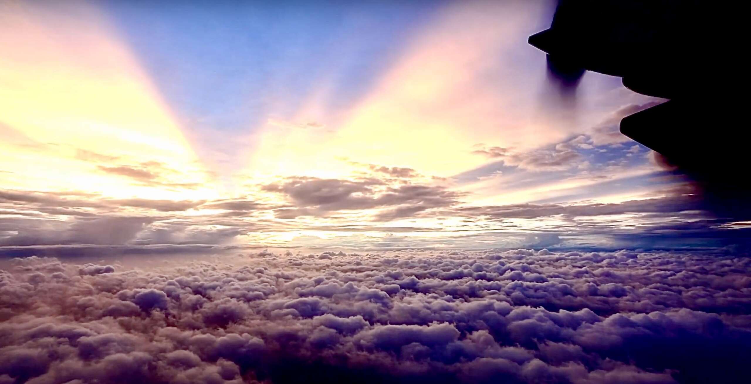
Suddenly, everything was calm. The plane was inside the eye of Hurricane Beryl, cruising in a perfect cylinder of pale blue sky, surrounded on all sides by dark banks of cloud.
Veteran hurricane hunters call it the ‘stadium effect’.
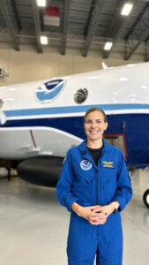
It’s surreal and strangely beautiful, says Hurricane Hunter flight director and meteorologist Kerri Englert, who led one of two crews on multiple reconnaissance flights during the recent storm.
“You go from these intense winds to everything just being completely silent and completely calm,” she said.
Inside the Lockheed WP-3D Orion aircraft the mood was less serene.
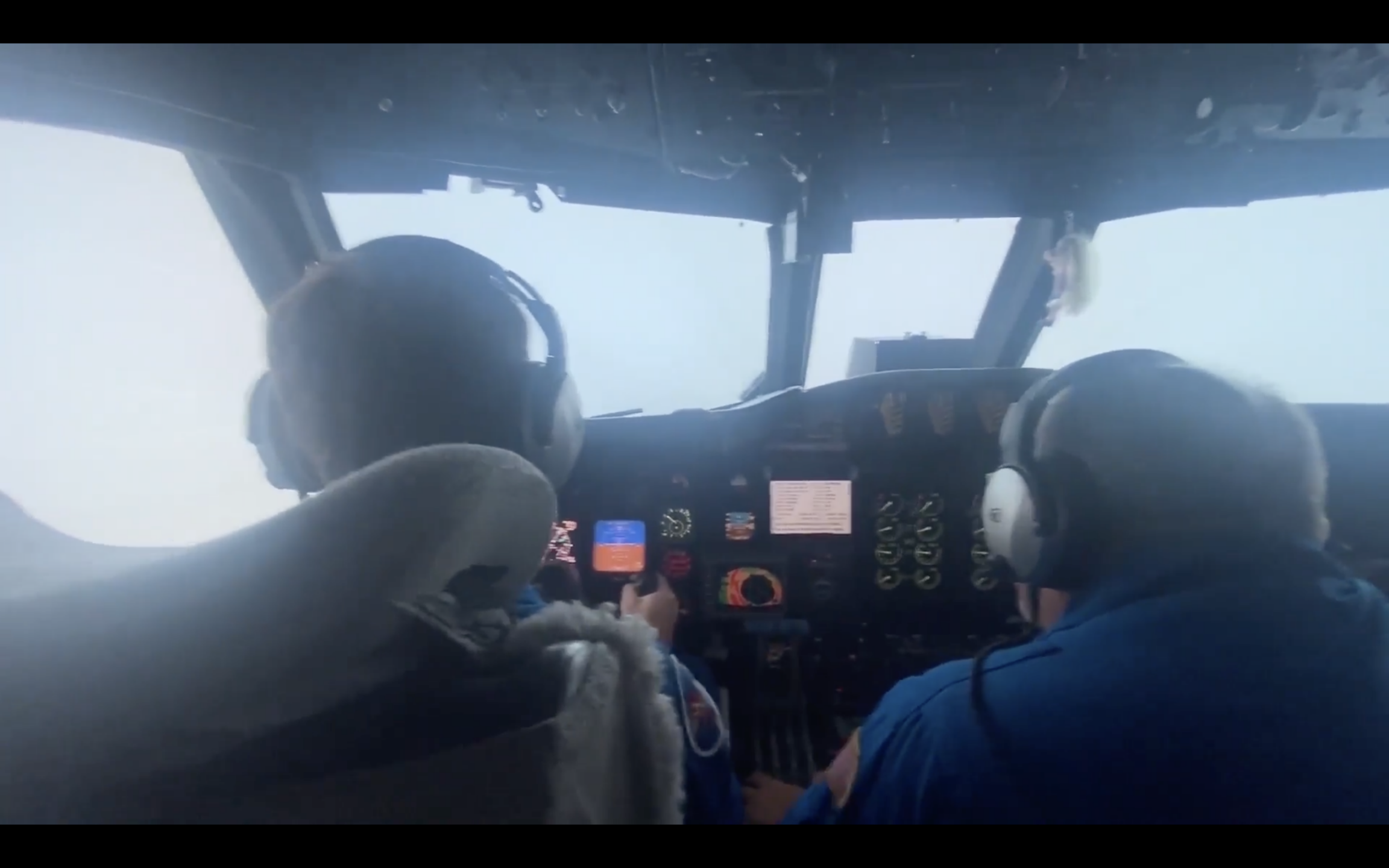
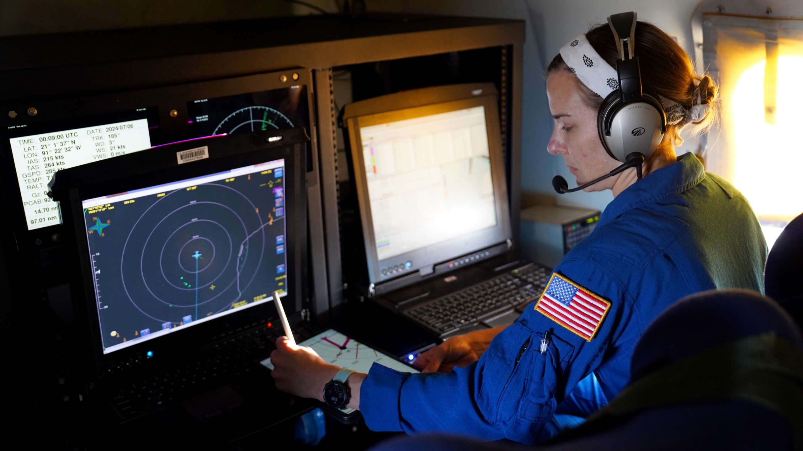
“That’s a busy time for somebody like myself,” said Englert, who is in charge of a crew of around 16, including scientists and researchers taking every conceivable measurement of the storm.
They are responsible for relaying precise data, including the exact geographical location of the storm’s centre back to the US National Oceanic and Atmospheric Administration.
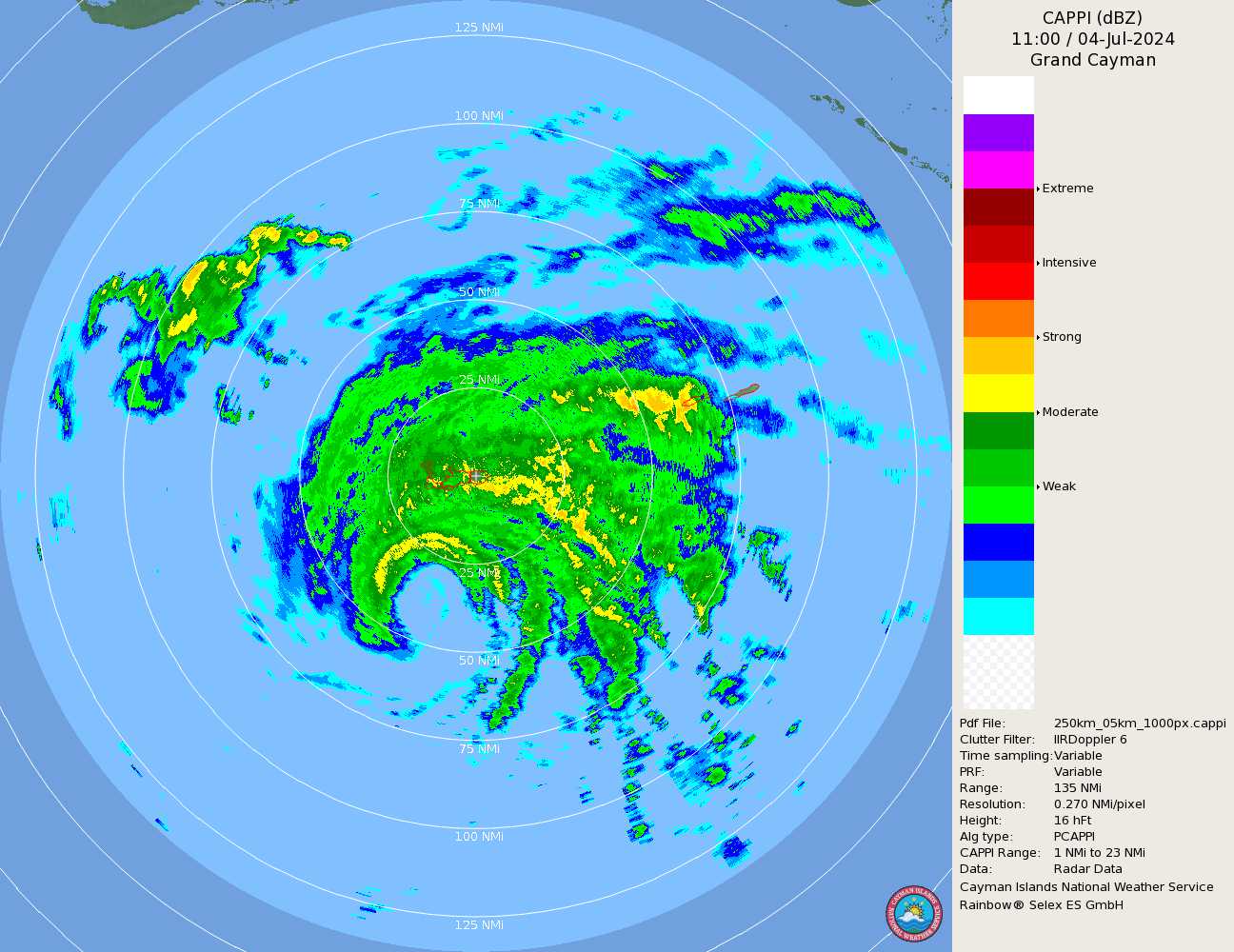
That information helps inform the images and forecasts we see on the Cayman Islands National Weather Service website as well as the risk warnings which trigger action from government and Hazard Management Cayman Islands.
The Hurricane Hunter plane flies a complete transect of the storm.
Sometimes the islands under threat are visible below. Other times the plane is totally smothered in thick cloud.
Lifesaving missions
There were several reports as Beryl passed by Cayman of planes overhead.
Flying out of St. Croix during the storm’s passage through the Caribbean, Englert and her team dissected Beryl on nine separate occasions.
The robust planes are specially adapted to withstand incredible wind speeds. And highly trained pilots use radar to plot a course and a speed through the storm that minimises the risk.
Englert is used to people thinking she is crazy. But during these flights her own safety is not what she is concerned about.
“We might get a bit of turbulence but for those of us who have been through a hurricane and seen it from the ground as well, you know firsthand the type of impacts that storm is causing for the communities below.”
The former US Navy pilot likens flying a storm to a lifesaving military mission. The only difference is the ‘target’ is the storm and the purpose is to provide information that can save lives.
Into the eye of Hurricane #Beryl!
This season is in full swing and WP-3D Orion #NOAA42 “Kermit” is gathering data for forecasters from @NHC_Atlantic. These flights also support @NOAA_AOML hurricane research.
Visit https://t.co/3phpgKNx0q for the latest forecast & advisories. pic.twitter.com/Uvi4lacAvw— NOAA Aircraft Operations Center (@NOAA_HurrHunter) July 1, 2024
The data from precision instruments on board is quickly translated into usable information we can see on our phones or laptops in the Cayman Islands.
Exploring the storm
One thing those maps can’t fully convey is the three-dimensional nature of a storm.
Within that giant rotating ball of clouds, there are layers and depths – a complex vertical world of cloud and rain and wind that lacks the uniformity or symmetry suggested by a photograph or diagram.
“One of the reasons we are out there is to collect that information on the structure of the storm,” says Englert.
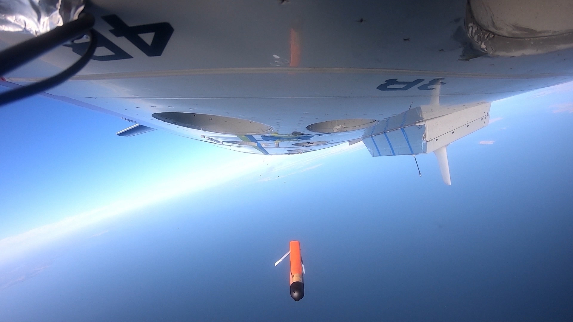
One of the key pieces of technology is a dropsonde.
Launched from the aircraft with a parachute attached, it collects information as it falls – sending real-time pressure, temperature, humidity, wind speed and wind direction data back to the aircraft and on to the US National Hurricane Center.
On the plane’s tail is a spinning doppler radar with a 50-mile vertical range that helps create a picture of the storm from top to bottom.
Englert developed a fascination for extreme weather as a teenager on vacation with her family in Daytona Beach when Hurricane Charley hit in 2004.
She went on to become a US Navy flight officer and later studied meteorology before joining NOAA and advancing to be a flight director on the Hurricane Hunter missions.
Flying into storms is not for everyone, she acknowledges, but for her it is the perfect use of her unique set of skills.
“I love flying into the storm, I think it’s just a fascinating capability that we have.
“I love everything from the weather itself to the operational mission of what we’re doing, the data collection and the impact as far as the warnings and evacuations. That is the lifesaving side of it.”
Q&A with hurricane hunter Kerri Englert
What does it feel like to fly through a storm?
A lot of people say it is like a roller coaster through a carwash or a washing machine. That’s not precisely right but I guess it is the best way you can really describe it because you do get those positive and negative Gs when you experience that kind of turbulence.
What does the storm look like. Can you see anything?
You’re going to lose visuals, whether it’s due to darkness or just because you are in the thick of the clouds. You’ll see the water coming down the sides of the aircraft out the windows, but that’s about it at times.
What is it like inside the eye?
There is this beautiful ‘stadium effect’ when you punch through into the eye wall … It is like you stuck a straw right through a birthday cake and you can just see the hole straight down, from top to bottom.
You can see the sun above you, or the moon if it is night time, and the ocean below. It is surreal.
What was it like going into your first storm?
It was Hurricane Earl and it was something I had wanted to do for years. So I was thrilled just to get to have a flight or get to have that opportunity to do it in that capacity.
How do people react when you say your job is to fly into storms?
It’s s a mixed bag. You get some people who say, ‘That’s so cool, I want to do it’, and then you get other people who say, ‘You’re absolutely crazy’. It’s a pretty even split.
How does someone become a hurricane hunter?
There’s a lot of varying backgrounds here but I would say to be a flight director, you need a background in meteorology, hands down.
Related Videos


