
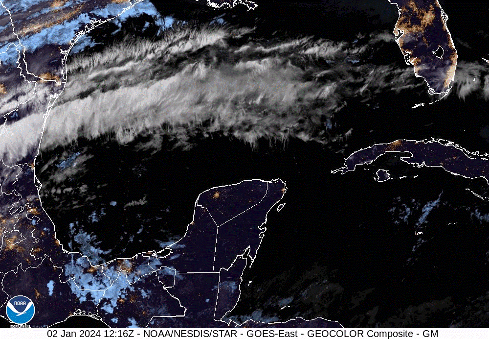
Forecasters say a lingering high-pressure system just north of the Cayman area is expected to block an approaching cold front in the coming days.
A massive sheer of clouds which spans across the Gulf of Mexico, and can been seen by NOAA satellites, will most likely be diverted across the northwestern portion of Cuba before heading over the southern parts of Florida and out into the Atlantic Ocean.
Although this new cold front is not expected to impact Cayman, forecasters say cooler temperatures and fresh northeasterly winds are likely to continue into the weekend.
“Temperatures will remain stable, that is around 75 degrees (Fahrenheit) during the nights and then to about the mid-80s in the days,” forecaster Allan Ebanks told the Compass on Tuesday, 2 Jan.
According to Ebanks, the current windy weather conditions, which have prompted a small craft warning, are likely to continue into Friday, at which time a switch in wind directions could result in a return to warmer temperatures.
“The models currently show that wind could switch and start coming from the south east, bringing with it warmer temperatures as it travels across the sea surface and into our area,” said Ebanks.
He added that the high pressure system is likely to also shift away from the Cayman area by Friday.
Related Videos


