
Temperatures across Cayman could plunge by as much as 20 degrees overnight and last throughout the weekend, according to Cayman’s National Weather Service, thanks to a cold front that is looming on the horizon.
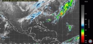 As of Friday 28 Jan., the mass of cold, dry air, which stretched on for hundreds of miles, was making its way into the central regions of Florida.
In its Friday morning forecast, the National Weather Service of Miami warned that the weather system could bring “some of the coldest air in about a decade,” which prompted the Miami NWS to issue a “wind chill watch and a freeze watch”.
Jan 28: A strong cold front will move through the region tonight with a few showers. Temperatures will plummet with some of the coldest air in about a decade moving into South Florida. A wind chill watch and a freeze watch have been issued for Sunday morning #flwx PIC.TWITTER.COM/S0N53ZI23H
— NWS Miami (@NWSMiami) January 28, 2022
Closer to home, Cayman’s National Weather Service has also been watching the developing weather system.
“We expect the cold front to enter into our area by Saturday afternoon, at which time temperatures could drop to the mid-60s to low-70s,” said forecaster Shamal Clarke.
“Additionally, we are expecting an increase in the strength of winds to between 15 to 20 knots from between Saturday and Sunday, and then a general tapering off by Monday morning and into Tuesday of next week.”
Clarke said the approaching weather system is not like typical cold fronts of the past, which would see a shift in Cayman’s normal westerly prevailing winds to a northwesterly direction.
“Instead, this cold front will see a shift to a more northerly direction,” said Clarke. “Once the initial front has passed, we also expect a large area of cold, dry air to continue after, which might also bring with it some thundershowers.”

A cold front occurs at the boundary of colliding cold and warm air masses. When the two meet, the cooler air sinks and forces the warm air to rise. The result is a drop in the temperatures closer to the ground, followed by an increase in showers, as the rising warm air cools and condenses.
In 2020, two separate cold fronts, which made their way across the US, caused record numbers of frozen sea turtles to wash ashore, as well as thousands of green iguanas to fall from trees, as the temperatures plunged. Forecasters across the US say a similar event could occur with the approaching cold front, for some southern states like Florida.
“Fortunately, we in Cayman will not have to worry about raining iguanas, because the temperatures are not expected to drop to the same levels as in the US,” said Clarke.
“The coldest times are expected to be on Saturday and Sunday night.”
Related Videos


Plummet ? Bring it on. 😊
I’m not concerned with raining iguanas, rather when are we going to get our weather radar back?. I e mailed them a week ago, but no reply.
The Government weather service:
https://www.weather.gov.ky/
has had a redesign. It looks pretty but it only given minimal information about any day beyond today. Thus one cannot find the answer to the simple question:
Will it be too rough tomorrow to take a boat out?
I have emailed to suggest they have future days’ forecasts as previously but no reply.