
A broad area of low pressure is expected to develop in the Gulf of Mexico over the next five days.
If it becomes organized, it has the potential of becoming the first named storm of the 2022 Atlantic Hurricane season.
In a Sunday morning advisory, the US National Hurricane Center gave the area a 30% chance of formation over the next five days.
It comes as Hurricane Agatha formed in the Eastern Pacific basin.
The NHC said the area of low pressure could form over the southwestern Gulf of Mexico, or northwestern Caribbean Sea, by the middle of the week.
“Some gradual development is possible thereafter while the system drifts generally eastward or northeastward,” the NHC has said.
Saturday night, Hazard Management Cayman Islands said it could form from the remnants of Agatha.
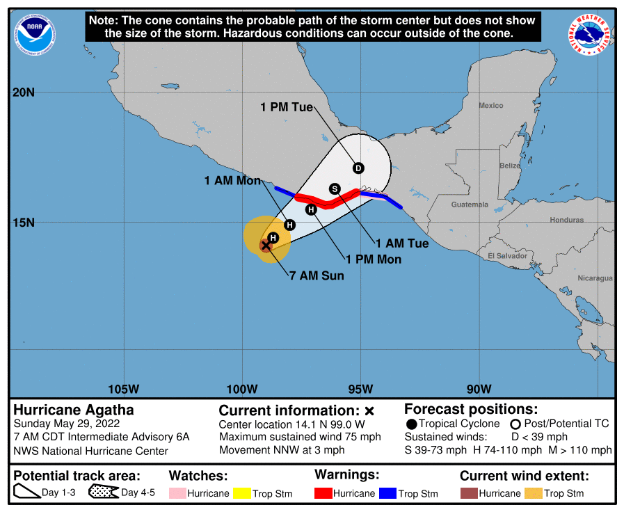
Hurricane Agatha is about 200 miles west south west of Puerto Angel, Mexico, and is registering maximum sustained winds of 75 miles per hour.
Additional intensification is anticipated until it makes landfall on Monday, the NHC said.
“Agatha is moving toward the north-northwest near 3 miles per hour. A turn toward the northeast is expected later [Sunday,] with a slow motion toward the northeast continuing through Monday night. On the forecast track, the center of Agatha will approach the southern coast of Mexico later [Sunday] and make landfall there on Monday,” the NHC said in a forecast.
Hurricane-force winds extend outward up to 20 miles from the center, and tropical-storm-force winds extend outward up to 80 miles from the centre.
Related Videos


