
The Cayman Islands did not just dodge a bullet this week. It dodged a bomb.
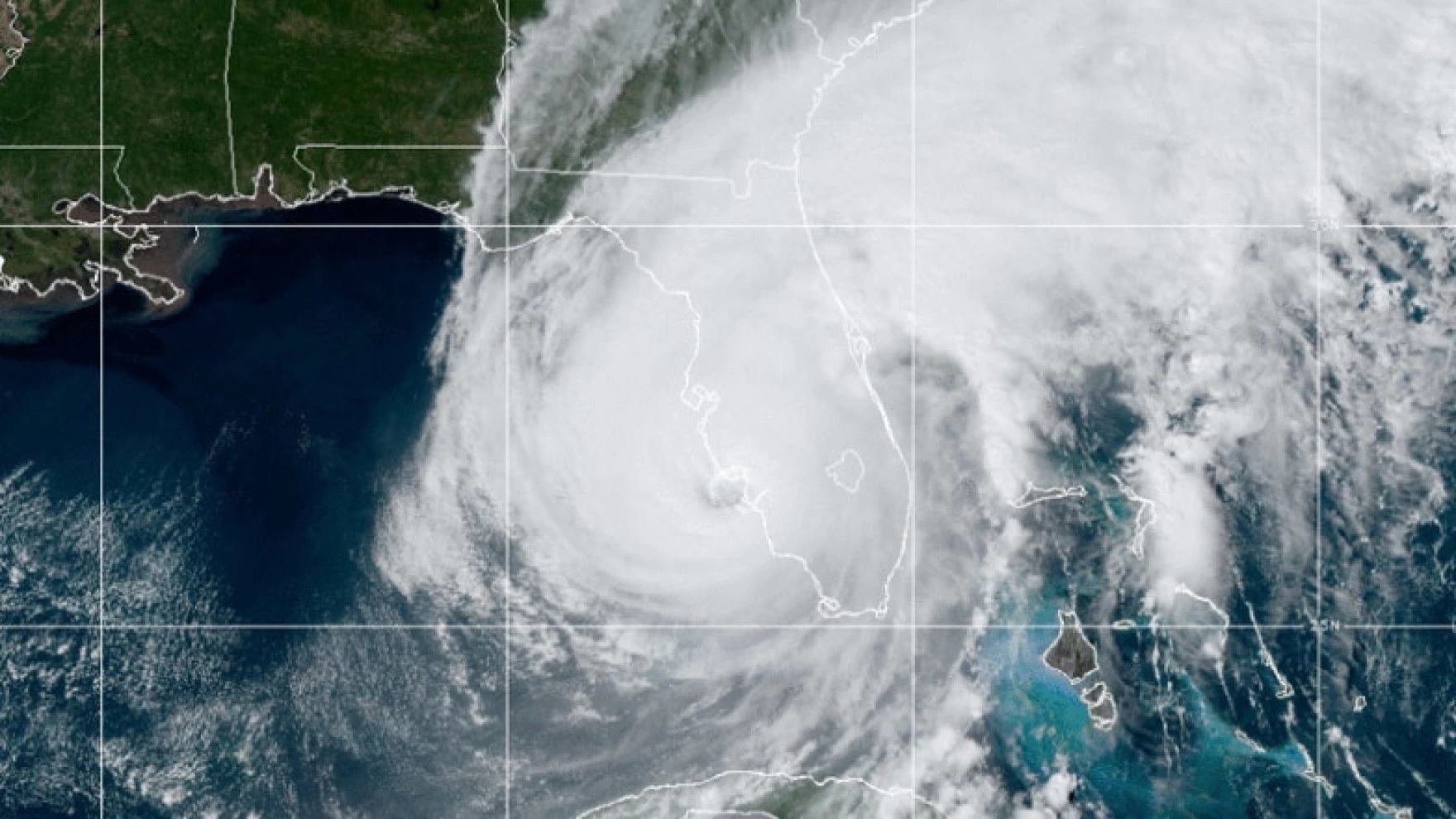
That was the prevailing sentiment as Hurricane Ian, which sideswiped Grand Cayman, morphed into a category 4 mega storm that pulverised Florida.
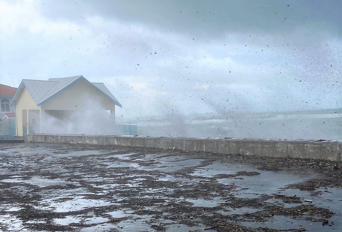
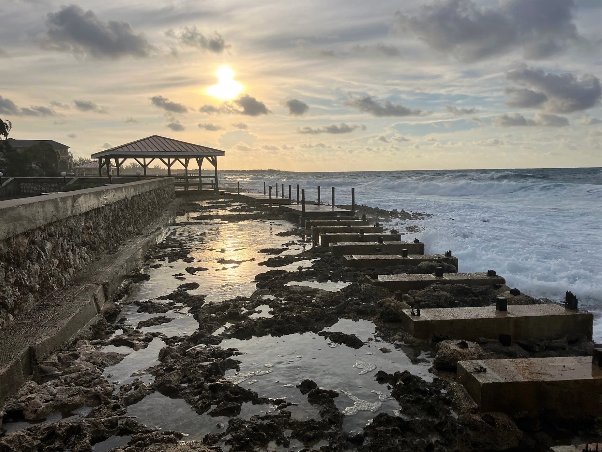
The surging seas that pummelled the US’s most southerly state Wednesday offered a terrifying glimpse of what might have been.
Hurricane Ian’s unpredictable path could easily have put Cayman in its cross-hairs.
And while Floridians living in vulnerable coastal communities were able to evacuate inland, Cayman’s leaders are painfully aware that for the 72,000 people living on these low-lying islands, there is nowhere to run.
Almost 20 years after Ivan, the latest storm – just one letter removed from its historic predecessor – once again posed the most basic existential question for Cayman: Are we equipped to survive another hit of that magnitude?
It is not a simple yes or no question.
Learning experiences
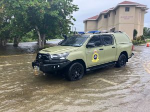
Premier Wayne Panton, Governor Martyn Roper and Hazard Management Director Danielle Coleman all told the Compass the islands are better prepared and more resilient than they have ever been.
But the size and strength of storms in the region in recent years – Dorian in the Bahamas, Irma in the British Virgin Islands, and now Ian in Florida – have served as urgent reminders that the threat level is also escalating.
“The reality is if you have a big hurricane, you are going to have significant damage to property and you are going to have people who are very concerned,” Panton said.
Governor Martyn Roper said certain impacts were inevitable in the case of a major direct hit.
“I don’t think you can ever be ready for a big one. It is a huge challenge but you have to be as prepared as you can be for whatever happens and I think our crisis response system in Cayman is one of the best in the region.”
Despite those comments, both men say Cayman gets stronger and more battle-ready with every storm.
After Ivan in 2004, the building code was reformed to ensure new property was built at least six feet above sea-level.
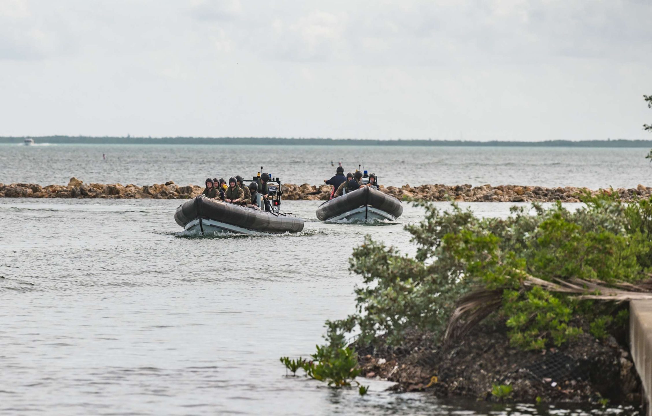
The partnership with the British navy – emphasised again this week with the deployment of the HMS Medway to Grand Cayman after Ian – has added a new layer to the emergency response level.
The introduction of the Cayman Islands regiment has created a well-trained and increasingly well-equipped force of first responders.
Meanwhile, Cayman Islands Hazard Management has established itself as the hub of the islands’ disaster response.
A recent hydrographic survey will arm that unit with even more accurate data to model the likely impact of as many as 100,000 possible storms.
Those simulations will generate information that can be used to protect the most vulnerable communities and inform planning decisions.
But there is no room for complacency, says Panton.
His ministry aims to embed ‘climate resiliency’ into planning and infrastructure decisions, anticipating that high-impact storms like Ian are likely to become more frequent events.
Every hurricane is different and each one is a stress test on the system, a chance to identify weaknesses and to be as ready as possible for the real thing.
“We’ve had an Ivan scenario and we obviously learned tremendously from that,” the premier said. “Dorian took that up a notch in terms of the potential concerns that we need to really be focused on.”
Dorian, a slow moving category 5 storm, lingered over the Bahamas for three days in September 2019, leaving 50 dead and thousands homeless.
“In the past, those type of impacts might have been regarded as extreme considerations,” said Panton. “Today, with the threat of changing weather patterns, climate change and increasing storm intensity, those extreme situations are things which may become more common.
“We have to really up our game, we have to be prepared to an even higher level.”
Climate change intensifies threat
At Hazard Management, Coleman agrees that the threat is only getting greater.
The rapid-intensification of storms – a factor which makes them more dangerous and unpredictable – is an anticipated feature of climate change.
While Cayman is far better prepared now than it was in 2004, when Ivan struck, there remains much to do.
“The threat is so high and we are so close to sea level – an average of seven foot – so climate change, rising tides and stronger storms are going to seriously impact us in future,” Coleman said.
While the building code was toughened up after Ivan, there remains scope for more informed planning decisions matched to the threat level.
“We need to be doing everything we can in Cayman to make sure that we are mitigating against those threats and making sure our development practices are very strong.”
The confirmation of the powers of the National Conservation Council to impact planning is expected to help with that situation. And Hazard Management would also like to be involved in decisions over how and where to build.
100,000 hurricanes
The department will soon take custody of a powerful new data set that will help it give advice on the areas that face the most significant threats.
While the Ivan flood map has served as a de-facto risk diagram of what could happen in the worst case, that’s just one iteration of the many possible shapes, sizes and approaches of hypothetical future storms that could hit Cayman.
A $1 million sea-floor mapping project funded by the UK government last year has provided baseline data that will enable Cayman to take advantage of a US Agency for International Development research project.
US-based weather experts will feed up to 100,000 possible storm scenarios into a simulator to create a detailed risk map for the territory.
The research, carried out by experts at the National Oceanic and Atmospheric Administration, will clearly demonstrate danger zones across all three islands for all possible storms.
Cayman’s Lands and Survey Department is in touch with NOAA to share the data, which could be processed before next storm season.
David Broughton, deputy director of Hazard Management, said it would create a much more precise picture of which areas would be vulnerable to different types of storms.
“The surge model involves running approximately 100,000 hurricane scenarios, including different angles of approach, wind velocities, size of wind fields,” he said,
“The model will allow government to provide a vastly improved estimate of surge height before impact, which then allows Hazard Management to more accurately pre-plan mitigation, prevention and response activities, such as evacuation protocols and the pre-deployment of emergency assets, which greatly improves emergency response capability and therefore the ability to save life.
“It also allows for greater understanding of planning needs and requirements in areas of identified high risk.”
Crisis experience
Governor Roper said the partnership between the UK and Cayman was helping make the islands among the best prepared in the region.
A UK Ministry of Defence team had been embedded with the National Emergency Operations Centre and the HMS Medway had reached Cayman in short order to be ready to help where needed.
He said a lot of the same teams had worked closely together through COVID and learned from that experience. “We’ve had hurricanes, tropical storms, we had COVID, we had an earthquake. We had so many crises to deal with. The team gets better each time and learns from every one,” he said.
Related Videos


NOAA data shows 5% intensity increase this century, but a 20% frequency decrease.
Hurricanes are just part of the bargain living in the Caribbean. We rebuild and renew, we try again – because the life benefits of life here far outweigh the burdens.