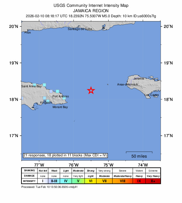
Early on Tuesday, 10 Feb., residents in the eastern parishes of Jamaica felt the ground shaking, as a Magnitude 5 earthquake occurred at 3:16am, 52 miles east of Machioneal, Portland, Jamaica.
The earthquake occurred at a depth of six miles, and while numerous residents in Jamaica reported feeling the quake, there were no reports of damage.
The day before, on 9 Feb., the United States Geological Survey (USGS) recorded a swarm of more than 35 minor tremors north of the British Virgin Islands.
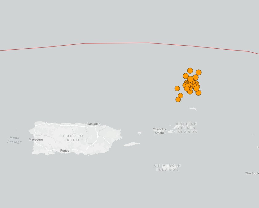
These earthquakes ranged from magnitude 3 to magnitude 4.4, and due to the low magnitudes and the distance away from land areas, very few people felt these events.
On Sunday, 8 Feb., another stronger Caribbean earthquake occurred shortly after 7am. This earthquake registered as a 5.5 magnitude event, and occurred close to the southeast coast of Cuba, 29 miles away from the town of Maisí.
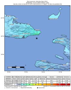
Reports indicate that residents across the province of Santiago were awakened by shaking buildings, rattling windows and swaying household items, prompting many to move outdoors as a precaution while authorities activated nationwide safety protocols.
In Havana, residents also described brief but noticeable ground movement, with light fixtures swaying and small objects falling from shelves. In southern provinces, the shaking felt stronger, lasting several seconds and accompanied by a low rumble.
Despite the shallow depth – six miles – of this earthquake, there were no reports of damage in Cuba.
Caribbean seismic environment
The Caribbean region sits atop a complex network of tectonic plates that sometimes generate seismic activity. Despite some quite large earthquakes occurring in region close to the Cayman Islands, there have been no reports of any earthquakes causing significant damage.
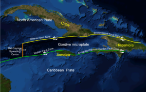
On 28 Jan. 2020, a 7.7 magnitude earthquake occurred 80 miles east southeast of Cayman Brac. Another significant earthquake occurred on 14 Dec. 2004, and while this earthquake was much less strong than the 2020 event, it was closer, with the epicentre located just 20 miles south of George Town, Grand Cayman.
Both events were associated with (left-lateral) movements on the transform plate interaction between the North American and Caribbean plates.
Related Videos


