Meteorologists at the National Weather Service say a potential cyclone in the region is unlikely to lead to Cayman being placed under a storm watch or warning, but are nonetheless urging residents to monitor the system’s progress.
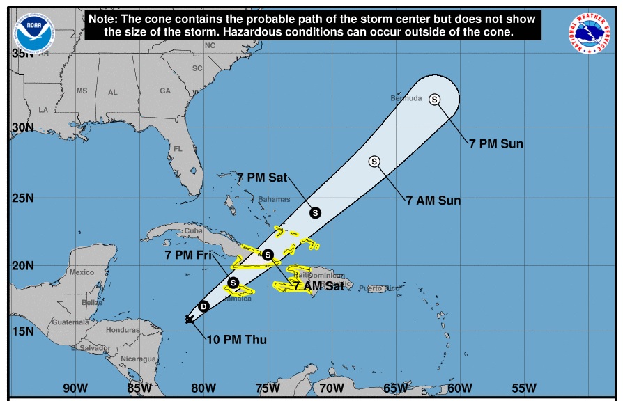
Potential Tropical Cyclone 22, at 10pm, was located about 234 miles south of Grand Cayman and some 319 miles west-southwest of Kingston, Jamaica.
On its current path – which has shifted slightly westward from earlier in teh day – the closest the storm is anticipated to be from Grand Cayman is about 185 miles to the southeast around 9am Friday, and pass 142 miles to the southeast of Cayman Brac around 3pm.
The storm is moving towards the north-northeast at 8 mph, with sustained maximum winds near 35 mph.
The National Weather Service, in its 10pm advisory, said the forecast track continues to takes the storm over Jamaica by Friday evening.
“The Cayman Islands are not likely to be placed under any watch or warning at this time. Residents are urged to monitor the progress of this storm,” the NWS said.
By Friday night, the storm is expected to start to push away from the northwest coast of Jamaica and move into the Atlantic by Saturday morning.
“This system may support some showers across the Cayman area, but a decrease in cloudiness and showers are expected from [Friday] evening as the system moves into the Atlantic by Saturday,” the weather service stated.
The National Hurricane Center, based in Miami, Florida, has been issuing advisories about the system.
The Cayman weather service said it would continue to monitor the developments of this system and any impacts it might have on the Cayman Islands.
Related Videos


