
For the latest information on storm activity in the Cayman Islands, as well as information on how to prepare for hurricane season, visit Storm Centre.
Following a slow start to this year’s hurricane season, the Atlantic is becoming much more active, with the US National Hurricane Centre tracking five systems, including two named storms – Emily and Franklin – this weekend.
Currently, none of the systems pose a threat to Cayman, but Hazard Management Cayman Islands is advising residents to ensure they have storm preparedness plans in place as the hurricane season shows signs of increased activity.
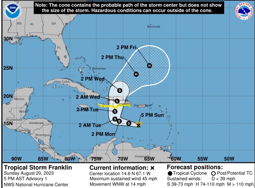
The Cayman Islands National Weather Services said it was monitoring newly upgraded Tropical Storm Franklin, which at 4pm was located 270 miles south-southeast of the Dominican Republic, with wind speeds of 45 mph.
Tropical Storm Franklin is moving west-northwest at 14mph.
The National Hurricane Center in Miami, Florida, says Franklin is expected to approach Hispaniola late on Tuesday, and move across the island on Wednesday, bringing heavy rainfall, strong winds and high sea surges.
The National Hurricane Center is also issuing advisories for Tropical Storm Emily and Tropical Depression Six.

As of 1pm Cayman time Sunday, Tropical Storm Emily was moving west-northwest at 10 miles per hour, with maximum sustained winds of 50mph. The storm is expected to weaken into a post-tropical remnant by Tuesday.
Related Videos


