
For the latest information on storm activity in the Cayman Islands, as well as information on how to prepare for hurricane season, visit Storm Centre.
Scattered showers across the northwest Caribbean associated with Tropical Depression 10 will spread into the Cayman area over the next few days, Cayman’s National Weather Service said on Sunday.
The rainfall could cause flooding of low-lying areas, the NWS said in its Sunday morning forecast.
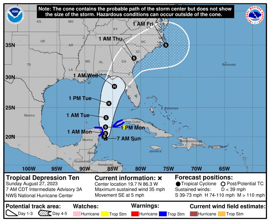
Tropical Depression 10 is set to intensify into a storm and is expected to strengthen into a hurricane over the eastern gulf of Mexico in a couple of days, the US National Hurricane Center said in its 7am advisory on the system.
Moderate southerly winds are expected across the Cayman area over the next few days as the system moves northward, the NWS says.
“Radar images show numerous showers in and around the Cayman area drifting towards the north-northeast,” it added.
While the motion of the storm takes it towards North West Florida, the NWS says showers associated with it may still spread across the Cayman area over the next few days.
“Some shower may be heavy at times and flooding of low-lying area is a possibility,” the NWS forecast said.
The outlook for the Cayman Islands Sunday includes temperatures in the low 90’s °F. Winds will be south to southwest at 5 to 10 knots with higher gusts in and around heavy showers, the NWS says.
Seas will be slight with wave heights of 1 to 3 feet becoming rough around heavy showers.
Overnight, skies are expected to be partly cloudy with a 40% chance of showers and some thunder.
“Showers will be locally heavy at times, leading to possible flooding of low-lying areas. Temperatures will fall to the mid 70’s °F. Winds will be southerly 5 to 10 knots with higher gusts in and around heavy showers. Seas will be slight with wave heights of 1 to 3 feet becoming rough around heavy showers,” the NWS said.
Tropical Depression 10 was located 70 miles southeast of Cozumel, Mexico at 7am on Sunday.
“The depression is moving toward the southeast near 5 mph (7 km/h), and it is likely to meander near the Yucatan Channel through early Monday. A faster motion toward the north or north-northeast is expected later on Monday, bringing the system over the eastern Gulf of Mexico,” US National Hurricane Centre forecasters said Sunday morning.
Maximum sustained winds are near 35 mph (55 km/h), with higher gusts and forecasters say the depression is expected to become a tropical storm later on Sunday and a hurricane by Tuesday.
Related Videos


