
The phrase “super El Niño” is appearing in headlines around the world, but climate experts say Cayman should focus less on the label and more on what the developing weather pattern is likely to mean locally: hotter temperatures, reduced rainfall and an increased risk of heatwaves.
The Cayman Islands National Weather Service has already issued a heatwave outlook for the 2026 wet season, warning that above-average temperatures are likely as the Pacific Ocean transitions from ENSO-neutral conditions into El Niño.
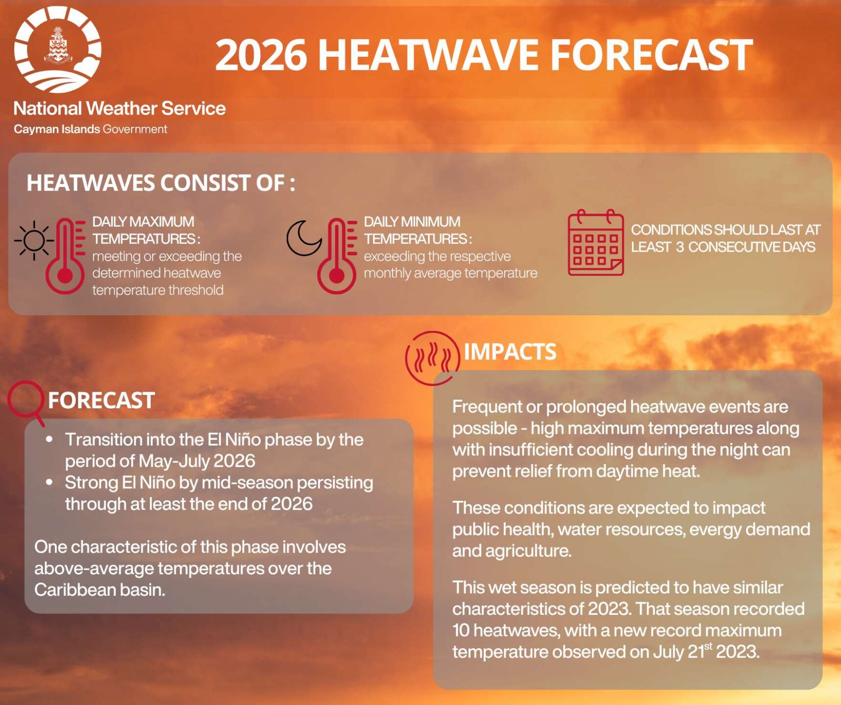
According to the weather service, heatwaves occur when maximum temperatures meet or exceed established thresholds, overnight temperatures remain unusually warm, and those conditions persist for at least three consecutive days.
Forecasters expect a greater than 70% probability of above-average temperatures and a greater than 70% probability of below-average rainfall across the Cayman Islands this rainy season.
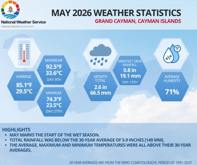
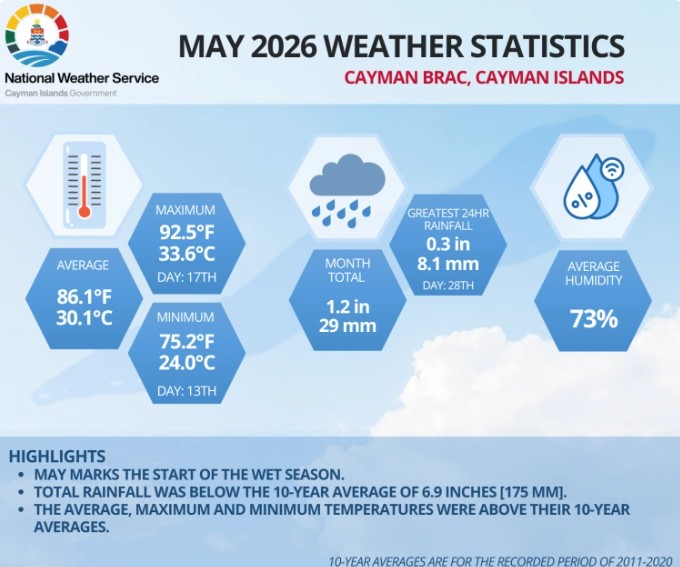
The most recent National Weather Service statistics show that trend has begun, with both less rainfall and higher than average temperatures recorded for the month of May.
The outlook is drawing comparisons with 2023, when Cayman experienced 10 heatwaves and recorded its highest temperature on record – 95.5°F (35.3°C) on 21 July.
“The concern is not just hotter afternoons,” local meteorologist Kerrie Forbes noted, “Warm nights can prevent people from recovering from daytime heat, increasing health risks and adding stress on energy and water resources.”
The National Weather Service expects temperatures to remain above average throughout the wet season, while rainfall is forecast to be below average. Average seasonal rainfall is 47.6 inches in Grand Cayman and 33.5 inches in Cayman Brac.
Ultimate strength of El Niño remains uncertain
The developing El Niño is one of the key climate drivers behind that forecast.
The latest outlook from the National Oceanic and Atmospheric Administration’s Climate Prediction Center indicates an 82% chance that El Niño will develop before the end of July and a 96% chance that it will persist through the Northern Hemisphere winter. However, NOAA stresses that the ultimate strength of the event remains uncertain.
That uncertainty is important because the term “super El Niño” has become popular in media reports despite not being an official scientific classification.
The World Meteorological Organization has specifically noted that it does not use the term, and NOAA’s own forecasts currently show a range of possible outcomes, from weak to very strong, with no single strength category dominating the forecast.
Private forecaster AccuWeather believes El Niño conditions are already becoming established in the tropical Pacific and estimates there is a 30-40% chance the event could eventually reach “super” status. Even so, AccuWeather meteorologists caution that strength alone does not determine impacts.
Potential impacts for Cayman
For Cayman, one of the more significant consequences may be a reduction in Atlantic hurricane activity. El Niño typically increases upper-level wind shear across the Atlantic, making it more difficult for tropical systems to organise and strengthen.
The Cayman Islands National Weather Service, NOAA and Colorado State University are all forecasting a below-average Atlantic hurricane season. Colorado State University’s updated June forecast issued on 10 June, now calls for 11 named storms, five hurricanes and two major hurricanes, below the long-term averages of 14.4, 7.2 and 3.2 respectively.
But forecasters continue to emphasise a familiar warning: It only takes one storm to make a season memorable.
While hurricane numbers may decline, heat risks are expected to increase. Public health officials worldwide increasingly view extreme heat as one of the deadliest weather hazards.
Residents can reduce their risk by staying hydrated, limiting strenuous outdoor activity during the hottest part of the day, checking on elderly relatives and neighbours and paying close attention to heat advisories.
Related Videos


