Between a steady onslaught of Saharan dust coming off Africa all the way through the Caribbean region, and the impacts of an El Niño weather pattern now gathering strength in the equatorial Pacific Ocean, the forecast continues to call for a less active Atlantic Ocean hurricane season.
That doesn’t mean, however, that there will be no tropical activity in the region and the National Hurricane Centre in Miami began monitoring two areas of interest late this week.
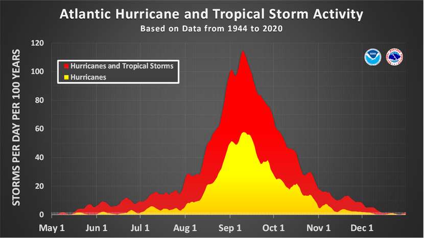
Although neither system is expected to impact the weather in the Cayman Islands, the simultaneous occurrence of two areas for interest is a reminder that late July is a time when tropic cyclone activity has historically started ramping up – and will continue to do so all the way to 10 Sept., which marks the climatological peak of the Atlantic hurricane season.
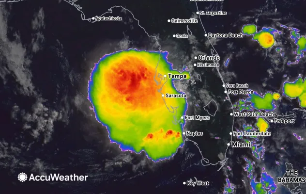
One of the areas being monitored by the National Hurricane Center is in the far Eastern tropical Atlantic Ocean near the Cape Verde islands and has a low chance, 10%, of developing into a tropical cyclone over the next seven days as it moves west-northwest toward open seas. The other area of interest is closer to Cayman in the northern Gulf of Mexico. Even though the National Hurricane Center gives that area of disturbed weather only a 30% chance of tropical cyclone formation over the next seven days, it is expected to bring wet weather to portions of Florida.
The National Hurricane Center said the weather system was associated with an upper-level low and a surface trough. “Some gradual development of this system is possible while it meanders northward, bringing heavy rain to portions of the Florida west coast during the next several days.
AccuWeather believes climate conditions could allow this weather system to strengthen.
“Wind shear is expected to weaken across the northeastern Gulf this weekend into early next week,” AccuWeather Lead Hurricane Expert Alex DaSilva said. “This, combined with exceptionally warm sea surface temperatures in the middle to upper 80s F, or 2-4 degrees above the historical average, can create favorable conditions for tropical development.”
Cayman’s dust alert discontinued
The Saharan dust that caused hazy skies and poor air quality on Grand Cayman earlier this week was discontinued by the National Weather Service on Friday, 17 July as the main plume drifted west of the Islands.
Another plume of Saharan dust is expected to begin entering the eastern Caribbean on Sunday.
“The second plume of Saharan dust is expected to reach south of Jamaica by Tuesday evening and expected to maintain a track south of Cayman,” the National Weather Service said in its Thursday, 16 July evening forecast. “Therefore, dust related alerts may not be expected with this event.”
Related Videos