
A tropical wave which is interacting with an upper-level system over Grand Cayman has produced thundershowers that have drenched the island in more than an inch of rainfall.
“We expect similar weather conditions to continue throughout tonight and on into tomorrow with intermittent breaks,” Cayman Islands National Weather Service forecaster Avalon Porter told the Compass on Thursday.
In its midday forecast for 24 June, the NWS said, “Radar images show isolated showers around the Cayman area moving west.”
Porter said although only one inch of rainfall was recorded by the weather station, which is based at Owen Roberts International Airport, other privately owned weather stations recorded down more than two inches in some parts of Grand Cayman.
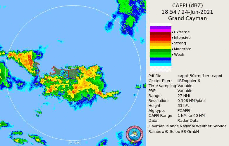
“We cannot speak to the calibration of those instruments,” said Porter. “However, an informal glance of the recordings reveals as much as two-and-a-half inches of rainfall fell in some parts of West Bay.”
The current tropical wave which is supporting thundershowers is expected to move out of the Cayman area by Monday. However, Porter warns that it is unlikely that weather conditions will improve.
“There is another tropical wave in the eastern Caribbean that will eventually make its way into the Cayman area, and that is likely to happen right as this tropical wave moves on,” said Porter.
Further East
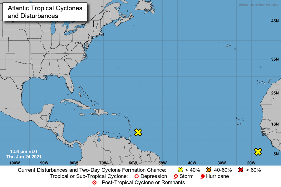
The National Hurricane Center in Miami, Florida, is monitoring an area of disturbance which is currently located on the edge of the Caribbean; further east, the NHC is also monitoring a system off the coast of Africa.
As of 2:30pm, the first system was located 100 miles east-southeast of Barbados, and was travelling west-northwest at 10 miles per hour. The NHC said the system has since “degenerated into a trough” and had a 0% chance of developing into a tropical cyclone due to unfavourable weather conditions.
However, Porter warns that this system could make its way into the Cayman area in the coming days, and when it does, it is expected to bring more thundershowers.
“The system that we should keep an eye out for is the one that is off the coast of Africa,” said Porter, adding, “Of course, it is still too early to tell which direction it will travel.”
Related Videos


