The Hazard Management Cayman Islands team has embarked on a pilot project to create a technology-based early detection warning system to alert the public about potential flooding in urban areas.
The six-month project, which involves the installation of flood sensors at key locations, recently commenced with the first sensor being installed in a well on the Government Administration Building compound on Elgin Avenue in George Town.
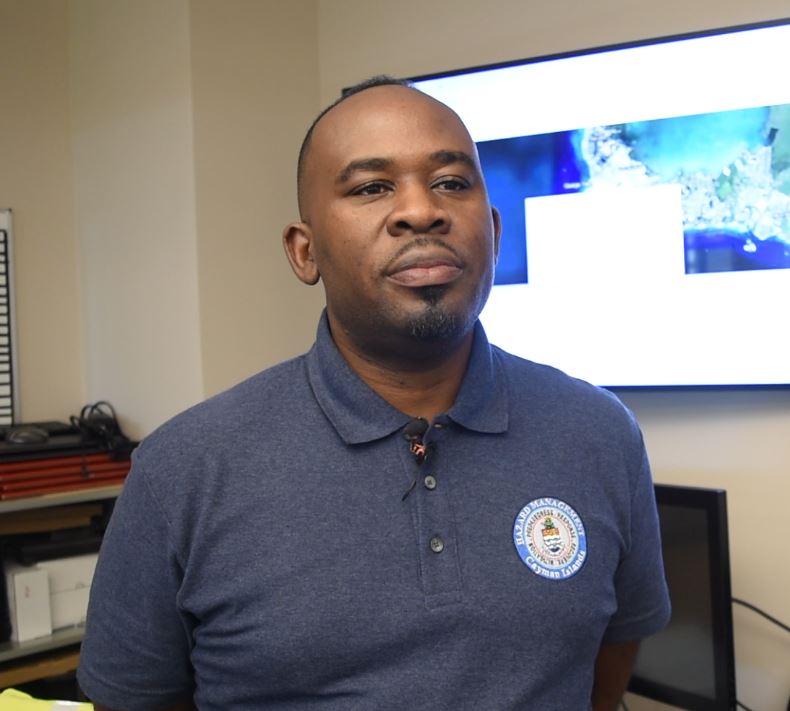
Hazard mitigation specialist and project lead Mark Codling said the initiative is a key component in modernising Cayman’s risk detection and management system, and that the data collected will not only reduce loss, but save lives as well.
“If we are able to monitor what the water level is like as it relates to extreme rainfall events, we’re able to forecast and predict when there will be a significant flooding taking place. So, we’re trying to collect data over a period, using that data as part of a historical database and applying techniques, some AI technology as well, [to] look at predictions in that area,” he said.
The importance of evaluating and measuring the impact of ‘hydro-metrological’ events on local communities, he said, has created a significant demand for increasing the safety of socio-economic assets.
“If we look across, especially, urban space, … what we are seeing are areas that are referred to as not so permeable, where water is unable to absorb, and there is a significant runoff because, of course, construction is taking place in certain areas,” he said.
An early warning, Codling said, would help mitigate the consequences of severe flooding and potentially save lives.
“The need for a ‘smart flood early warning detection system’ presents an opportunity for monitoring inundation levels in local communities through an intelligent IoT (Internet of Things) sensor network,” he said.
How it works
According to tech website Oracle, the Internet of Things is the “network of physical objects – ‘things’ – that are embedded with sensors, software, and other technologies for the purpose of connecting and exchanging data with other devices and systems over the internet”.
This is how the flooding sensors will be set up here.
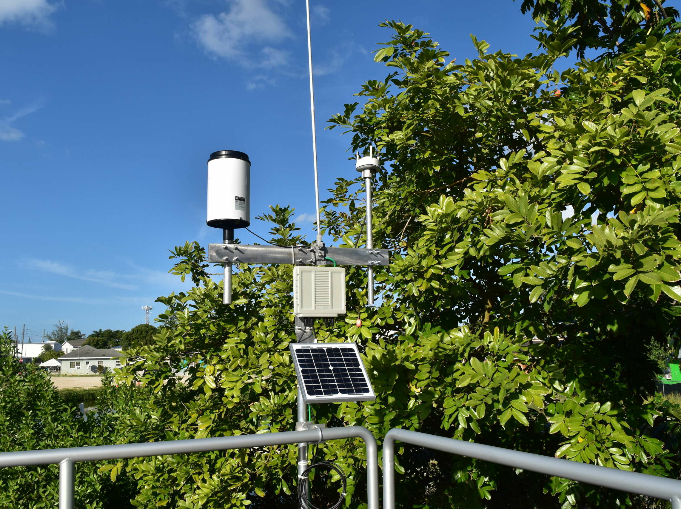
Codling said, at the Government Administration Building, there is a pressure sensor which has been placed in a deep-water well which is collecting information on the water table in that area.
A separate above-ground sensor receives the data from the well and sends it back to the Hazard Management monitoring centre.
“That information is transmitted wirelessly over a 4G network and that provides us real-time data as it relates to the water level,” Codling said. “So we’re able to monitor, essentially, the water table, and what we’re planning to do is to roll this project out into communities [that are] flood prone so we’re able to alert the public and let them know that the water level is rising in a particular area.”
Phase 1 of the project, he said, is the design and implementation of IoT Sensor Network. Following this will be phases 2 and 3, which include an artificial intelligence system (software), geospatial technologies for predicting flooding, and visualisation on a situational dashboard for water levels.
Codling said three more sensors will be rolled out in communities in Grand Cayman.
The team, he said, is looking closely at Randyke Gardens in George Town and Butterfly Circle in Savannah for installations.
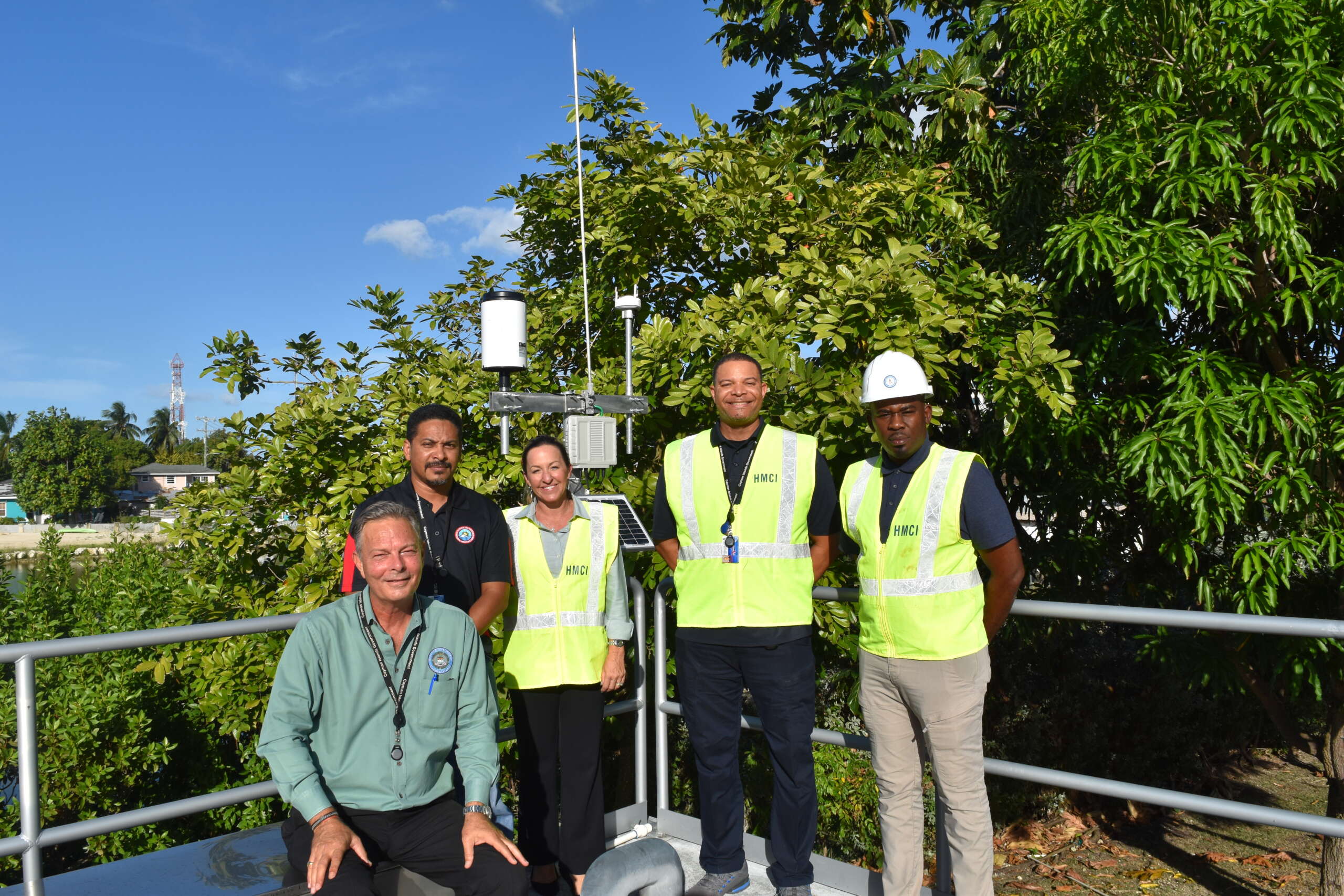
Leslie Lennox Vernon, manager for Hazard Management logistics and telecommunications, said the government building was identified as a suitable location because some research and understanding on what the device will provide in terms of information is needed, and the team was not sure exactly how much interaction would be needed with the device itself.
“Having it here at Government Administration Building gives us the ability and flexibility to interact with the device hardware and identify any challenges that we may have. For example, being out in the elements, there might be a case for damage and so we would quickly be able to address it here,” he explained.
Hazard Management director Danielle Coleman said, given that the Cayman Islands, on average, is seven feet above sea level, tides and storm surge pose significant risks; therefore, having evidence-based data will help in decision making when it comes to responding to hazards.
“I think this flood sensor will go a very long way to making sure that we understand what the risks are, and again, how do we respond and be proactive with making sure our communities are safe,” she said.
She added that some of the sensors may need to be installed on private property, and she appealed to the community to work with Hazard Management on the project.
“We’re trying to look at public land to install our sensors on, and also we want to make sure they don’t get vandalised. It’s really important, if you do see a flood sensor, it’s not just there to look pretty. It obviously serves a really big purpose, to keep people of the Cayman Islands safe,” she said.
She added that engagement with private land owners is going to be absolutely critical to make sure the sensor is secure, “but also that we can have access to land when we need to collect that data”.
Improving weather predictions
Codling said the sensors will allow Hazard Management to collect data on rainfall, wind speed and temperature.
This data is shared with the National Weather Service and be used to enhanced existing prediction tools, chief meteorologist Kerry Powery said.

“Essentially, with these sensors in the field, we’ll be able to see what we’re predicting, compared to what’s actually happening, or [what] ‘in situ’ sensors tell us what’s actually happening. Based on our forecasting and what the models are projecting and what we see in the field, we’ll be able to give better advice to Hazard Management in terms of flooding expectations or the level of risk a potential weather event may cause to this particular area,” he said.
The more sensors are installed, he said, “the better our capacity will be able to give more detailed information for the specific areas”.
Most of the National Weather Service’s climatological data is based on the Owen Roberts International Airport, he added, which means there is generalised data on what’s happening in Grand Cayman.
There is one data point on Cayman Brac, he said, but that’s not as extensive as the data collected for Grand Cayman.
“Having more data points would give us a better picture of any climate changes and potentially help us to do some adaptations in the future based on what we see from this particular census,” he added.
When it comes to hurricane season, he said, the sensors will be critical to the community’s safety and Hazard Management’s response plan.
“While we are monitoring all the general overall [weather] patterns, we could look at the sensors’ data and see potentially, or estimate, what type of damages that particular area might be experiencing,” he said.
The information would feed back to Hazard Management, he said, which could then start preparing battle plans as to where it is going to respond first and what type of equipment will be needed to tackle the potential damage that is estimated, based on what the models are saying and what the in-situ instruments are transmitting.
Agencies, including the National Roads Authority; the Departments of Environment, and Lands and Survey; and the Water Authority, are also partners in the project.
Related Videos


