
Extensive seabed mapping data will enable Cayman Islands authorities to predict the likely impact of almost any hurricane, Hazard Management officials believe.
US-based weather experts will feed up to 100,000 possible storm scenarios into a simulator to create a detailed risk map for the territory.
The research, which will be funded by the US Agency for International Development and carried out by experts at the National Oceanic and Atmospheric Administration, will clearly demonstrate danger zones across all three islands. It could be used to fuel better emergency readiness, and potentially by the Central Planning Authority to make decisions about where to allow new development.
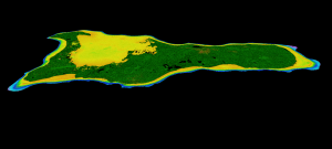
The project has been made possible by a UK-funded study to map the seabed around the Cayman Islands.
Armed with crucial data about the underwater geography of the three islands, disaster planners can better map the likely storm surge and other impacts in a variety of possible extreme weather events.
Simon Boxall of Hazard Management Cayman Islands said NOAA experts would be able to simulate storms of every different possible size, wind speed, wind field, velocity and angle of approach.
The current system of categorising hurricanes from 1-5, based purely on wind speed, is insufficient to assess likely threat, he said. The most dangerous scenario may not be a direct hit from a category 5 storm. There are many other variables, including size and angle of approach, that determine possible impact.
“That category (1-5) provides a very poor picture of what you might expect in terms of storm surge,” said Boxall.
Last year, Tropical Storm Grace, which was not even classified as a hurricane, brought more than five feet of surge in some areas and did more damage than much more highly categorised severe storms have in the past.
In 2008, Hurricane Paloma brought extreme winds, but with a relatively small radius of seven miles, it brought little storm surge – which often causes the most severe damage.
The end product of the research will be an extremely sophisticated “risk map and advance warning system,” for any possible scenario, said Boxall.
From a public relations perspective, he believes it will arm aid workers with specific science-backed projections to persuade people to evacuate their homes when necessary.
On a longer scale, Boxall added, it will help Cayman ensure its critical infrastructure is protected and its shelters are built in the safest areas.
He added that it could be a tool for development planning, to ensure new housing is not positioned in areas that face the greatest threat.
“We want to become more resilient, not more vulnerable over time,” he said. “We want to ensure we are building in ways that factor in issues like rising seas and storm threats.”
The potential for tsunamis, a relatively poorly researched threat to the Cayman Islands, can also be analysed using the new seabed mapping data, Boxall added.
He said the hurricane simulations would be carried out on a timescale to be agreed with NOAA and USAID, which is funding that aspect of the research.
The seabed mapping mapping survey, collected as part of a $1 million UK-funded project across the Overseas Territories, was shared with the government last month during an official handover by Governor Martyn Roper on behalf of the UK Hydrographic Office (UKHO).
Kerrie Howard, Hydrographic Programme Manager at the UKHO, said the data would have a number of useful applications for Cayman authorities, including improving navigation safety for mariners
“Seabed mapping data is an important foundation dataset that enables a wide range of uses beyond the safety of navigation, for example, habitat mapping, fisheries management, coastal zoning, coastal land use planning, climate change resilience, port developments, archaeology, emergency response planning, environmental impact assessments, marine infrastructure planning such as cable routing, and increased situational awareness for marine activities,” she said.
Related Videos


“The research … will clearly demonstrate danger zones across all three islands. It could be used … by the Central Planning Authority to make decisions about where to allow new development.” – This is the most critical step which has to occur next. There are a lot of implications of it, but more costs than benefits if we do not. Perhaps with this information soon in hand it would be good to do a proper development plan for the country?