
For the latest information on storm activity in the Cayman Islands, as well as information on how to prepare for hurricane season, visit Storm Centre.
Though Cayman escaped the worst of Hurricane Ian, people in Florida are hunkering down for the approaching storm, which is projected to reach Category 5 strength on Wednesday.
In response, Tampa authorities have announced the closure of the Tampa International Airport, effective 5pm on Tuesday, due to the projected path of the hurricane.
Cayman Airways on Tuesday night following that closure, announced the cancellation of its Tampa flights KX204 and KX205, both scheduled for Thursday.
“Affected passengers are currently being contacted and advised that their bookings will be rolled to flights KX200 and KX201 on Friday September 30, 2022,” CAL said in its release.
For help, CAL said affected passengers can call reservations at 949-2311 in the Cayman Islands or 1 (800) 422-9626 (toll free in the US), or contact their travel professional.
Meanwhile the national flag carrier has said due to the anticipated impact of Hurricane Ian, it will be offering a one-time change fee and fare difference waiver for affected customers travelling to/from Miami.
One-time change fee and fare difference waiver for affected customers travelling to/from Miami, provided that:
• Tickets were purchased on or before September 27, 2022
• Travel was scheduled between September 28 – 30, 2022
• There is no change to the origin or destination
• Travel must be rebooked in the same cabin
• New flights must be booked by October 5 , 2022
• All travel must be completed by November 10 , 2022Customers who meet all of the above, except for the “complete travel by” date, will still be eligible for the change fee waiver, but not the fare difference waiver.
Prior to the airport’s closure, evacuation of residents in the high-risk areas were carried out with a state of emergency being declared.
The US National Hurricane Center said in its latest advisory that Ian is forecast to make landfall on the west coast of Florida as a “catastrophic hurricane” which means it will be a Category 5 storm.
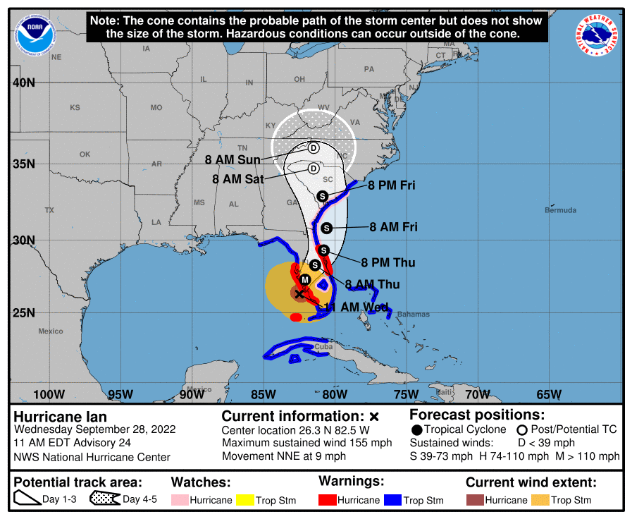
Ian is moving toward the north-northeast near 9 mph (15 km/h).
“This general motion with a reduction in forward speed is forecast today, followed by a turn toward the northeast on Thursday. On the forecast track, the center of Ian is expected to move onshore within the hurricane warning area in a few hours, move over central Florida tonight and Thursday morning and emerge over the western Atlantic by late Thursday. Ian is forecast to turn northward on Friday and approach the northeastern Florida, Georgia and South Carolina coasts late Friday,” the NHC said.
Maximum sustained winds remain near 155 mph with higher gusts, which makes the storm a Category 4 hurricane.
After making landfall though, the NHC said, weakening is expected, but Ian could be near hurricane strength when it moves over the Florida east coast Thursday, and when it approaches the northeastern Florida, Georgia and South Carolina coasts late Friday.
Related Videos


