
The Department of Environment has insisted that its statement and interactive map, which outlined its recommendations on planning applications of storm-damaged properties, was not an ‘I told you so’ exercise. Instead, it hopes it will make people reflect on the need for more effective setback regulations.
Lauren Dombowsky, manager of the DoE’s Environmental Management Unit, told the Compass this was the first time, following such a storm, that the department had gone back and specifically revisited the advice it had offered during the planning process on buildings and structures impacted by a storm.
She said DoE provides about 500 technical assessments and recommendations each year, so there is a very wide bank to choose from. In this instance, they chose only locations that had appeared on social media following the destructive nor’wester on 5-6 Feb.
‘Living document’
Matt Southgate, a DoE environmental management officer who previously worked as a civil and structural engineer in the private sector, compiled the map, which includes the recommendations made by the DoE, the response of the Planning Department or Central Planning Authority, and footage from the affected sites during and after the storm.
He said the map would be retained “as a living document” and would be updated when future storms occur.
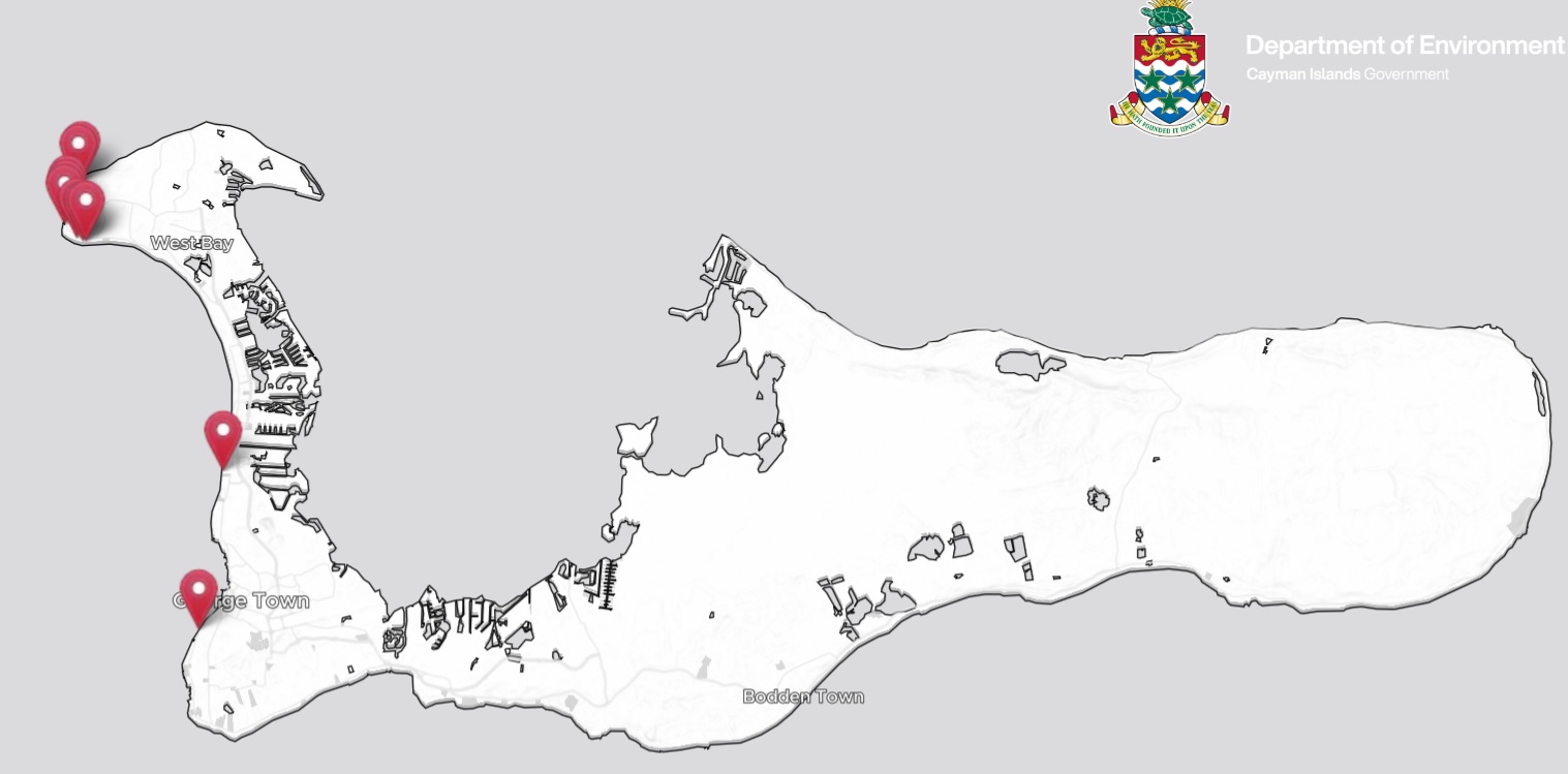
The main prompt for each of the sites in the map, which included Lighthouse Point Residences, Macabuca and Sunset Point in West Bay, and FIN in George Town, was video images circulated on social media of extensive flooding or of waves smashing over the sites.
Dombowsky acknowledged that coastal setbacks longer than the current legal minimum of 50 feet from sea-edge of ironshore, would not necessarily have “prevented all the damage those properties experienced, but it probably would have prevented some”.
“That is why, at least, the minimum setbacks, are required,” she added.
Current setback is 50 feet from the sea
Under the current Development and Planning Regulations, the minimum setback from the sea on an ironshore coast is 50 feet, although in many instances developers request a variance.
“When people apply for a variance, they are applying to go closer to the ocean than the legal minimum setback allows,” Dombowsky said.
The DoE is calling for the planning regulations to be changed, by amending the requirement for a general minimum setback to something more organic, that takes into account the location of the development, the type of ironshore, the position of the vegetation line, wave impacts and other elements.
“The mean high water mark changes depending on when you take it,” Dombowsky said. “One hour it could be here, the hour before, somewhere else.”
The DoE wants, instead of a standard 50-foot setback, a coastal setback reference line.
“That would create a line that would be more based on reality and be more reflective of environmental conditions,” Dombowsky said. “That line would create greater resilience than the current system, which is quite arbitrary.”
Vegetation line
Pulling up current and historical aerial maps of Grand Cayman, and some of the sites impacted by last week’s nor’wester, Southgate points to a vegetation line of one location in West Bay, which has been built at the 50-foot setback. The aerial images show the vegetation line at 180 feet from the outer edge of the ironshore, meaning that waves regularly inundate that area – right where the building and a sea wall now stand.
Dombowsky says she doesn’t want the message to be that buyers should not have bought property near the shoreline, but that information is available publicly, via Central Planning Authority minutes, that can help them find out more about the property.
“Sometimes, people don’t have all the information about a development,” she said. “They are buying on the assumption there have been checks and balances in place to ensure it is appropriately located.”
She encouraged people who have questions or concerns about coastal properties to contact the DoE at [email protected].
Uphill battle?
The DoE faced a struggle when it was helping to draft the National Conservation Act, which was actively opposed by developers and some politicians. After a plethora of amendments and delays, it was eventually enacted in 2013. It continues to have its detractors, and Premier Juliana O’Connor-Connolly has said changes are planned to the law to provide a new balance between protecting the environment and considering people.
Asked if the DoE feels its calls to amend the Development and Planning Regulations will face similar opposition, Dombowsky said, “When I did some of the public consultations for the Climate Change Policy last year, what I learned from some of the people I interviewed from the development sector was that most seemed to be OK with changing the regulations, as long as it applied to everyone equally.”
The Compass has reached out to the Department of Planning and the Ministry of Sustainability and Climate Resiliency for comment and is awaiting responses.
Related Videos


50 foot setbacks from the shore should be the absolute minimum. No variences ever. And higher off the ground on open-water facing properties.