
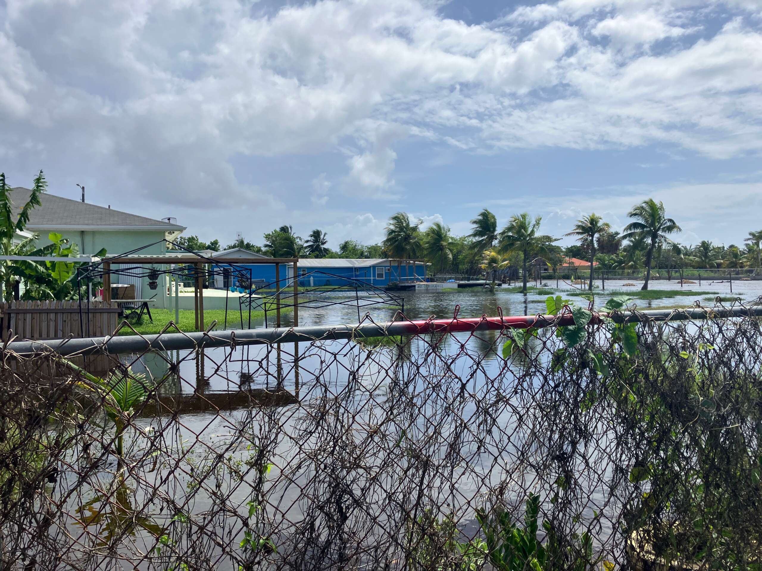
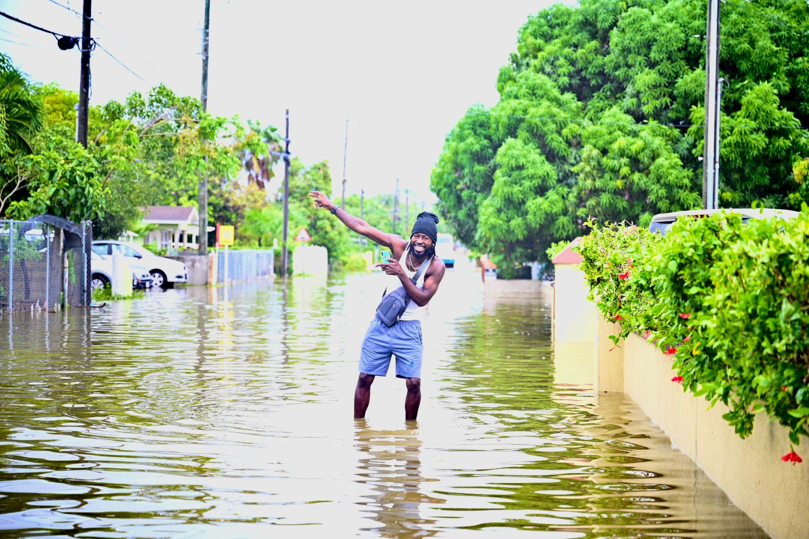
“How do you like our lake view?” Rachel Ebanks called out as mosquitoes buzzed around deep puddles pooling in her backyard and knee-deep floodwater lapped against her garden fence.
The adjacent fields, sometimes used for grazing cows, were dotted with snowy egrets wading in the standing water more than a week after the worst of the rains had stopped.
“We never used to get flooding like this,” insisted Ebanks, who has lived at the same property on Mars Close, West Bay for more than 30 years.
In past years, residents say the flooding would have been less extreme and would have drained away more quickly.
Opposite the flooded field, a partially-built housing development – its foundations poured to the new minimum grade level of 6 feet above sea level – stood high and dry.
The Legoland development is being built in compliance with planning regulations enacted post-Hurricane Ivan to ensure that Cayman properties would be better protected from storm surge and heavy rains.
But the unintended consequence of that regulation, homeowners in older, lower lying properties say, is that flooding for them has got worse.
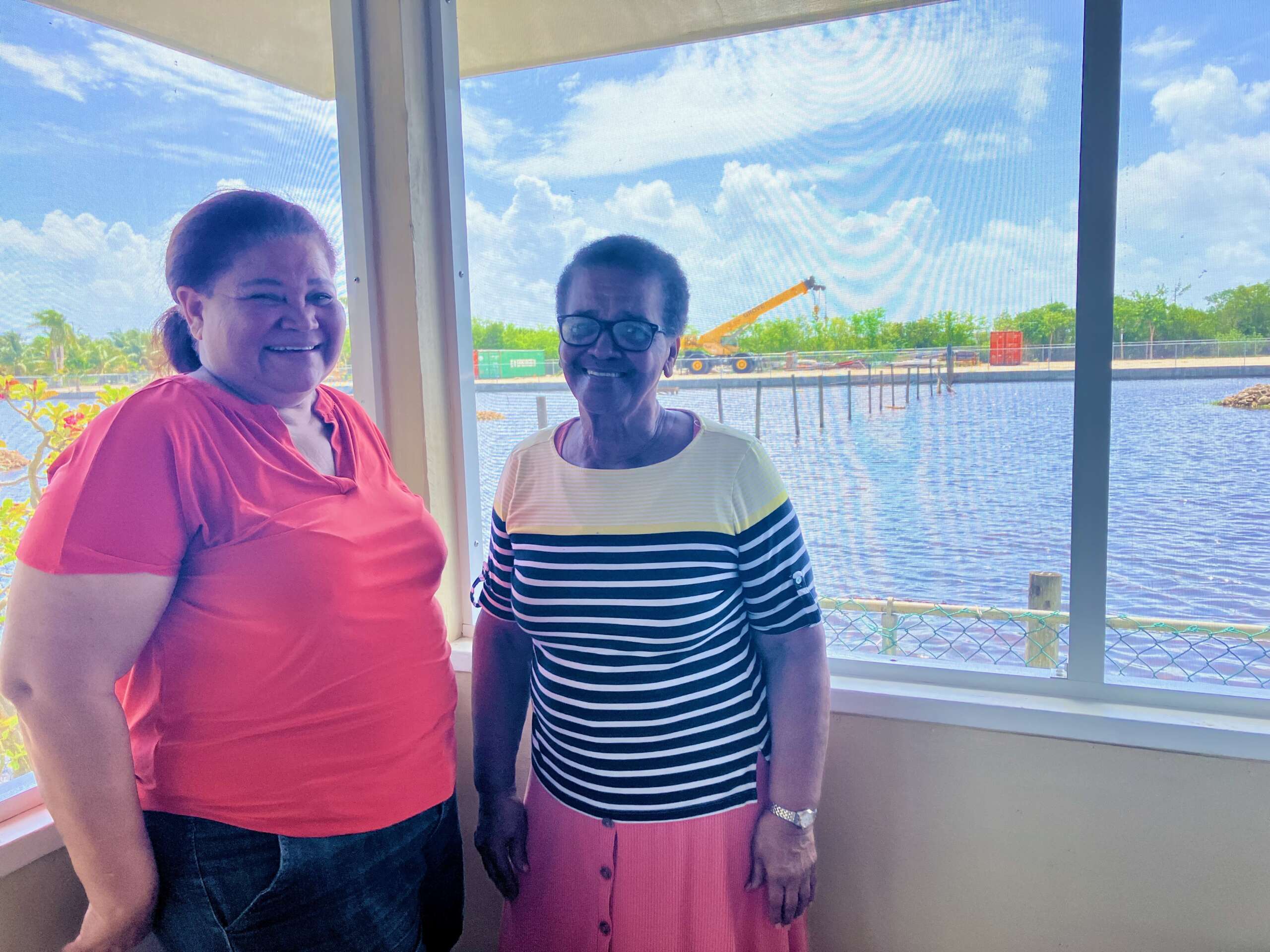
“I am going to be 84 next year and I don’t need this stress every time it rains,” said Miriam Williams, peering through her porch windows as the wind rippled through the floodwater.
“We are people too, just like them, trying to live our lives.”
The lingering concern voiced by both women is not so much what happened two weeks ago, which is a distressing nuisance, but the fact that an ‘extremely active’ hurricane season lies ahead.
“What happens when a major storm comes through?” asks Ebanks.
Architects for the developer insist they are working on a rainwater management plan which will lessen the problem, saying once all the deep wells are in place, it will become much easier to manage.
“Last week’s rain flooded pretty much the entire island’s lowlands,” said Eduardo Bernal, of Arco, on the Legoland project.
“The solution is to raise up levels with proper drainage which is exactly what we are doing.”
He added that the developer had complied with all the measures mandated by law, going beyond those requirements to add a retaining wall on the west of the property.
But residents question the ability of drains and deep wells to filter enough water away from their properties to make a significant difference.
“We can’t move our homes. We have been here for decades,” said Ebanks.
“We have appealed to government and they need to do something to help us.”
Ebanks and Williams have found themselves on the wrong side of the fence, with the island-wide flood risk map increasingly divided between older, lower lying homes and newer developments built to a higher level.
National problem
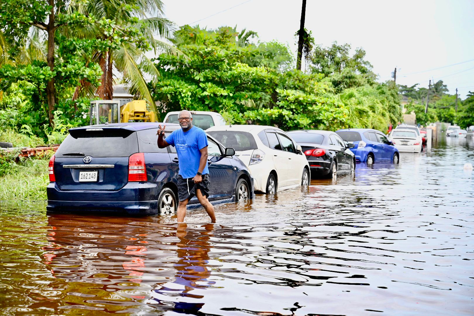
The situation is the extreme end of a national problem, with reports two weeks ago of flooding in areas that had previously not experienced that level of incursion.
While the rains were heavy – more than 6 inches fell in a single day – the problem was magnified by drainage issues that saw some areas below water for several days.
In South Sound, around Walkers Road, in parts of Bodden Town, and alongside the Linford Pierson Highway in George Town, flooding was particularly bad.

Many new homes and condo complexes have been built much higher above sea level in accordance with lessons learned during Ivan and absorbed into planning law. But residents in low-lying, older properties wonder whether filling in and raising up land for new building has essentially created artificial hills, directing more floodwater towards their homes.
There’s some truth to that, said Gina Ebanks-Petrie, director of the Department of Environment, who argues for a more comprehensive stormwater management plan.
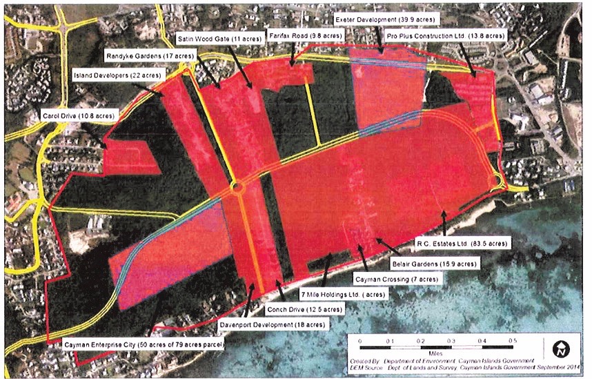
She said areas like Randyke Garndens had been identified as ‘flood plains’ for decades and a 2003 report recognised the need for a national stormwater management plan.
It’s illogical to expect rainwater to respect man-made planning boundaries, she said.
Cayman would ultimately need to come up with a series of inter-linking plans to manage stormwater run-off regionally throughout the island, Ebanks-Petrie added.
Altered landscape
Increasing development has not only altered the patterns of run-off in neighbourhoods, it has also seen the loss of mangroves and freshwater wetlands that acted as natural sponges to absorb and slowly release floodwater.
“We have removed a lot of the natural areas that would receive this extra run-off and areas that have never flooded before are flooding now,” she said.
“We have to take this more seriously and plan more regionally for stormwater management. We have known this for years but we have kicked the can down the road again and again.”
Possible solutions include incorporating natural features and permeable surfaces, rather than hard concrete, into new developments, or using regional ponds to contain water.
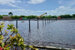
In South Sound, a system of conveyance mechanisms filters floodwater back into the lagoon. But so much wetland has been lost in the area, that the rate at which storm run-off runs into the ocean brings a pollution risk.
Questions over responsibility
Concerns around the management of drainage from new developments were echoed by the National Roads Authority during the debate over a recent planning application for 95 new apartments, by 20 North Development, in a low-lying part of West Bay.
The NRA raised concerns that the development could cause “major flooding issues for homes” in the area and that the applicant needed to think about a holistic stormwater management plan.
The NRA requested that the Central Planning Authority have 20 North Development draw up a strategic stormwater management plan, not just for the site, but for the area as a whole.
The project was approved without that provision, however, after the Central Planning Authority noted “if the NRA feels such a study is required, then the NRA should undertake the study themselves”.
Cline Glidden, who argued the case for the developer, told the Compass the drainage issue, in this and many other cases, was more complex than many believe.
He said newer developers often did enough to contain their own rainwater on site. The difficulty is that by building on previously undeveloped plots – which planning regulations require to be built as high or, in many cases, higher than neighbouring lots – they have removed the capacity for neighbours to essentially use their land as drainage. The result is that rainwater has to go somewhere else.
While that is a problem, Glidden acknowledged, he said it was unfair to lay it at the door of a landowner, who is trying to develop his own piece of property in accordance with his rights – the same way as his neighbours had already done. Equally, he said, with Cayman’s population having almost doubled in the last 20 years, it is unrealistic to expect that landowners would not seek to develop their plots.
In some ways, Glidden’s reasoning takes a different route to the same conclusion.
A national plan – or a network of regional plans – is needed to manage flooding.
National plan in the works?
Some of that is being considered as part of the PlanCayman process to update Cayman’s Development Plan.
The Compass sought comment for this story from Planning Minister Jay Ebanks, as well as the NRA and the technocrats behind PlanCayman.
We were asked to submit questions in writing through a ministry press officer.
In response, the planning ministry spokeswoman acknowledged that recent “unprecedented flooding had seen rainfall amounts that far exceeded what Cayman’s 50-year-old drainage system was capable of handling”.
She wrote, “While newer developments are built at higher levels to comply with post-Ivan regulations, creating what some residents perceive as mini hills, there isn’t definitive evidence that these developments alone have significantly altered flooding patterns.
“In this instance, the primary issue remains the extreme volume of rainfall in a very short period, which has posed challenges for all areas, irrespective of the development age.”
The spokeswoman also noted that the original roads, built half a century ago, did not include proper drainage systems.
Looking forward, she said the NRA has hired experts to help develop a national stormwater management plan with an initial focus on historically vulnerable areas.
“This comprehensive plan aims to address stormwater management more effectively across the island.”
Changes being considered include the incorporation of swales, and improved methods for the retention and collection of stormwater from each development.
Existing regulations already require developers to implement various stormwater management solutions to deal with their own rainwater.
“The PlanCayman initiative will address the feasibility of retaining mangrove areas for drainage purposes, balancing environmental preservation with property rights,” she added.
Rain, rain and nowhere for it to go
The challenges going forward are twofold.
Firstly, development continues to cause the loss of land – albeit in private ownership and zoned for construction of some kind – that had previously served as catchment for rainwater.
Secondly, rainwater ‘events’ – like the one earlier this month that led to the Cayman Islands Regiment being called in to escort children home from school – are expected to increase with climate change.
The planning ministry spokeswoman noted that an unprecedented 12 inches of rain fell in a 48-hour period from 8-10 June – part of a regional ‘extreme weather event’ that overwhelmed drainage systems in South Florida, Jamaica, Cuba, Honduras, Nicaragua and Mexico
“At home here in Cayman, it affected both old and new areas,” she added.
Extreme or the new normal?
Words like ‘extreme’ and ‘unprecedented’ could become redundant if even the most conservative projections of climate-change analysts come to pass.
The United Nations projects the Caribbean will experience a higher frequency of strong hurricanes and even super storms that surpass the current Category 5 terminology. There is also expected to be more frequent ‘rainfall events’.
For the residents on Mars Close, the rainfall this month has just been a frightening taster of what could be ahead.
Responding directly to the residents’ concerns, the ministry spokeswoman said the neighbouring Legoland development was being reviewed to determine if further mitigation was necessary.
“Residents’ concerns, such as a wall or a proper drainage system, are being taken seriously. Areas like this are part of the overall stormwater management plan to provide a long-term solution.”
The area, as a higher priority low-lying region, will be among the first to be addressed by that plan, she said, noting that some areas may require ‘heavy engineering solutions’ such as pump systems.
For Ebanks, those type of discussions are welcome. But she has been beating the drum about the challenges on Mars Close for over a year without getting what she considers a satisfactory response.
Residents are already making renovations to keep their homes dry. But, she believes, at the very least, government should help fund those resilience measures.
“This was just about a day-and-a-half of rain and look what happens? What if we get a real storm?
“Who is going to help the people protect their homes?”
Related Videos


And the developers takes their profits and move on to the next project. Then who pays the bill to help these ladies, the tax payers?
So more increase cost at the pumps, at the supermarkets, etc…how is this fair?
Drainage wells into the underlying aquifer are all over the island. Public works used to clear them of debris before the rainy season, but I haven’t seen that happen at least in the Walkers Rd area for some time. This results in the most of the drains being blocked and not removing any surface water.