
The Cayman Islands now stand at the forefront of ocean science in the Caribbean after completing one of the most ambitious seafloor mapping campaigns ever undertaken in the region.
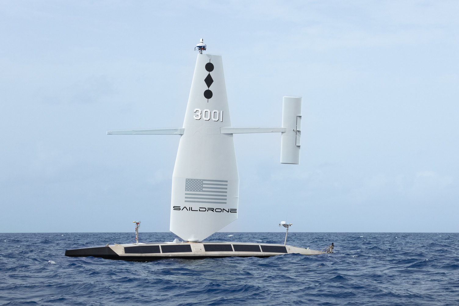
Using a fully autonomous Saildrone Surveyor – an uncrewed surface vehicle capable of operating for months at sea – 56,000 square miles of the Cayman Islands Exclusive Economic Zone (EEZ) has been mapped in high resolution for the first time.
Head of marketing and communications for Saildrone, Jenn Viskus, explained that the area is based on the inclusion of data collected by both Saildrone and the UK Hydrographic Office (UKHO).
Viskus said: “Through direct coordination with the UKHO, Cayman Government representatives, and the foundation funding the survey, it was agreed that Saildrone would survey only up to the recognized EEZ of the Cayman Islands, avoiding areas currently under diplomatic negotiation with Jamaica and Cuba.”
The boundary lines defining ownership of the maritime space between Cayman and the Republic of Honduras were previously established through treaty negotiations and confirmed in December 2001.
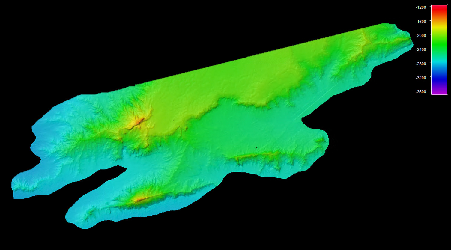
For a nation perched beside one of the deepest bodies of water in the world, the Cayman Trough (Trench), this new dataset represents a profound leap forward.
The Cayman Trench plunges to more than 25,210 feet, to the deepest waters in the Caribbean Sea. It is a realm close to freezing, pitch-black and inhabited by some of the strangest lifeforms on Earth. Until now, much of this frontier remained largely uncharted, its contours guessed at from sparse data gathered decades ago.
The Saildrone mission, which lasted roughly 300 days, has changed that. Equipped with advanced Kongsberg multibeam sonars capable of collecting data from shallow 60-foot shelves to abyssal depths of more than 21,000 feet, the surveyor delivered a modern, complete picture of Cayman’s underwater domain. Cayman is now the first Caribbean nation to achieve a deep ocean multibeam map of the majority of its EEZ.
Funded philanthropically by the London & Amsterdam Trust Company, the project leapfrogged decades of traditional ship-based surveys, operations typically too costly for small island states. Before this mission, Cayman had only 12,500 square miles of modern bathymetric coverage, mostly around the potentially mineral rich area to the southwest of Grand Cayman.
Earlier surveys
Although the Saildrone mission marks a technological milestone, the Cayman Islands’ undersea territory has been surveyed in far more rudimentary ways for more than a century.
The earliest efforts date back to the late 1800s, when British Admiralty crews used lead-line soundings, lowering a weighted rope over the side of a ship and recording single depth points by hand.
As vessels transited the region, additional soundings were gradually added, but the deep waters around the Cayman Trough remained largely blank.
A revolution began in the 1930s with the introduction of acoustic single-beam echo sounders, first true step into modern hydrography.
These early “fathometers” projected a single pulse of sound straight beneath the ship, creating narrow linear profiles of the seafloor. By the 1960s and 1970s, research vessels crossing the Caribbean basin used these systems to collect deeper measurements along scattered cruise tracks.
One of the most significant regional efforts was a revised bathymetric chart of the central Cayman Trough, assembled from “conventional wide-beam echo soundings,” published by Jacobs. This work provided one of the first detailed scientific glimpses of the trench’s dramatic topography. But because single-beam sonar measured only directly below the vessel, vast areas between ship tracks remained unmapped.
Only in the late 1970s did multibeam sonar systems become available for civilian science, producing broad swaths of continuous coverage for the first time. Even then, Cayman’s EEZ saw only limited mapping of a small portion of the Cayman Islands EEZ prior to the Saildrone mission.
In 2024, the Saildrone Surveyor arrived in Grand Cayman with a bold goal: deliver the first complete national EEZ map using an uncrewed platform.
The mission was not without challenges. According to the company, “Record sargassum blooms repeatedly fouled the Surveyor’s sound velocity profiler, forcing operators thousands of miles away to refine new remote cleaning and diagnostic techniques.”
The unmanned vessel also endured high seas and severe weather systems, remaining safely on task in sea state seven; conditions that would halt many crewed vessels.
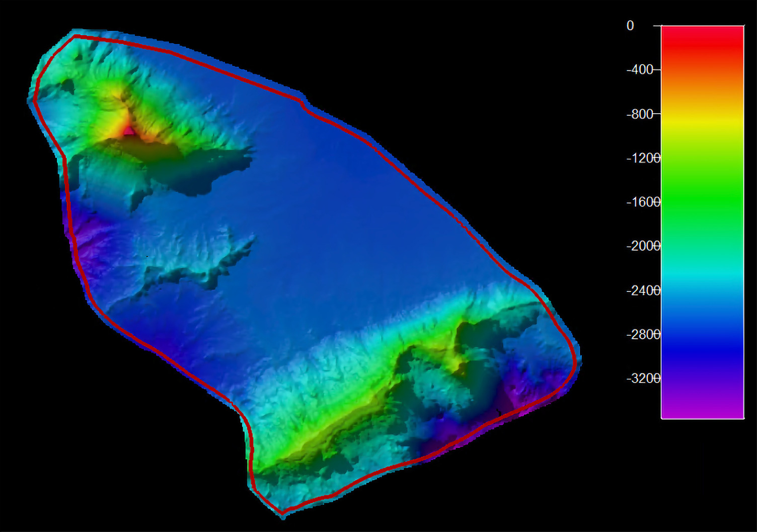
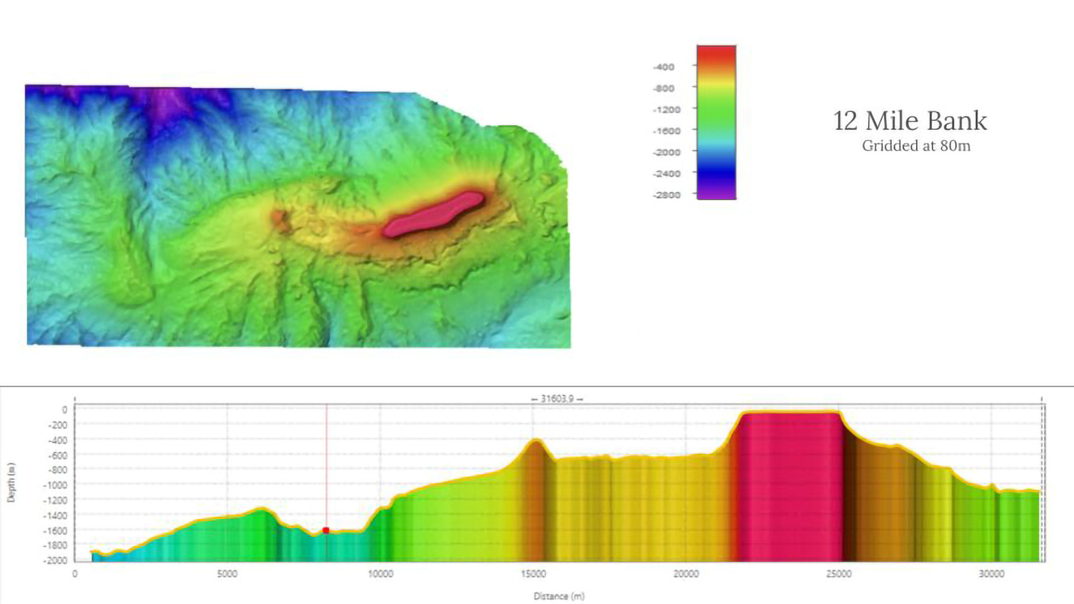
Four fishing banks; 60 Mile Bank, Lawford’s Bank, Pickle Bank, and 12 Mile Bank were among the highest-priority targets, given their role in supporting fisheries, tourism, and biodiversity. According to the press release from the company, the high-resolution mapping of these features will strengthen sustainable fisheries management and help protect fragile habitats.
-Image supplied
Beyond ecology, the data unlocks new pathways for Cayman’s blue economy: improved maritime safety and charting, offshore renewable-energy assessment and the potential for responsibly exploring marine minerals.
“All the raw data is now being transferred to the UK Hydrographic Office for charting updates, with contributions also destined for Seabed 2030, the UN-backed initiative to map the world’s oceans by 2030,” Saildrone said in its press release.
-Image: supplied
“This mission shows what is possible for small island nations,” said Saildrone VP Ocean Mapping Brian Connon. “Delivering high-quality deep-ocean data at this scale was once prohibitively expensive. Now it’s within reach.”
Related Videos


