
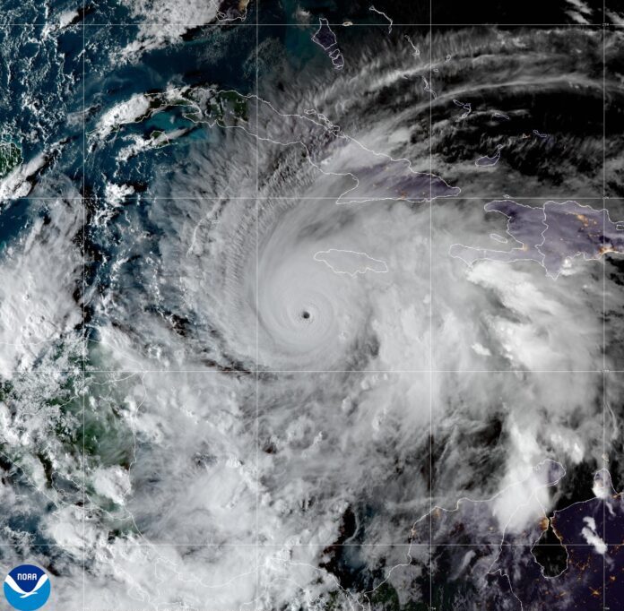
When Hurricane Ivan struck the Cayman Islands in September 2004, the tools available to forecasters and emergency managers were vastly different from those available today.
The satellites were less capable. Forecast models were less accurate. Artificial intelligence did not exist as a forecasting tool. Smartphones were rare. Social media had not yet emerged as a means of public communication. Cayman’s National Emergency Notification System did not exist. Neither did many of the technologies now routinely used to monitor weather, track storms and communicate risk.
A time of transition
As the 2026 Atlantic hurricane season begins today, the Cayman Islands National Weather Service is preparing to move into new headquarters, bringing together modern forecasting capabilities and improved infrastructure. Additional observing stations, storm-surge monitoring initiatives and a centralised weather data platform are all part of a broader effort to strengthen the country’s forecasting abilities.
At the same time, the service’s Director General John Tibbetts is preparing for retirement, marking the end of an era for a generation of meteorologists who learned their craft through observation, experience and an intimate understanding of local weather.
Turning data into understanding
Weather forecasts are now available from countless apps and websites. Artificial intelligence can generate storm tracks and rainfall projections in seconds. Global weather models are available to anyone with an internet connection.
But Cayman is not simply a point on a map. It is a low-lying island nation surrounded by warm water, exposed to hurricanes, storm surge, earthquakes, tsunamis, flooding and increasingly extreme heat. Understanding those risks requires more than a computer model. It requires local knowledge.
A global weather model may indicate heavy rain over Grand Cayman. A local forecaster understands what that could mean for South Church Street, Prospect, Bodden Town or other flood-prone areas. A hurricane forecast may show a storm approaching the western Caribbean. Emergency managers must determine what that means for Cayman’s utilities, vulnerable residents and critical infrastructure.
That process of turning data into understanding is becoming increasingly important.
The upgraded National Weather Service website reflects that shift. Forecasts now provide more insight into the reasoning behind expected conditions, helping the public understand not only what is expected to happen, but why forecasters believe it may occur. New colour-coded warning systems and clearer explanations of advisories, watches and warnings are designed to improve public understanding and encourage earlier action.
Still, forecasting the weather isn’t an exact science because so many variables come into play. Inaccuracies in weather forecases still can – and do – happen.
Manager of research and media services at the National Weather Service, Shamal Clarke said, “General forecasting for where a [tropical] system will move has improved, where the struggle remains is rapid intensification. Forecasting intensification is still a challenge,” he said, adding, “that is improving, too”.

Clarke said the introduction of new meteorology tools from artificial intelligence has also had a major impact on the accuracy of forecasts.
Increasing resilience through an integrated approach
At the national level, the National Emergency Operations Centre has evolved into a tried-and-tested mechanism for coordinating responses across government agencies, utilities, emergency services, the private sector and volunteer organisations.
The centre has been activated for hurricanes, earthquakes, tsunami threats and the COVID-19 pandemic.
Hazard Management Cayman Islands works alongside the Cayman Islands Red Cross, Adventist Development and Relief Agency Cayman, Community Emergency Response Teams, police, fire, health services and numerous government agencies to ensure that preparedness extends beyond forecasting.
The goal is not merely to predict a storm; it is also to ensure that people have an opportunity to survive it safely, and for the country as a whole to bounce back quickly and efficiently from an impact.
That means identifying vulnerable populations before disaster strikes. It means understanding where elderly residents live, which households may lack transportation, where language barriers exist and which communities are most exposed to flooding, storm surge or prolonged power outages.
Modern resilience is increasingly about local intelligence.
A warning may be issued nationally, but disasters are experienced locally.
The same hurricane can produce dramatically different consequences from one district to another. The same heat wave may be an inconvenience for some residents and a serious health risk for others. The same tsunami warning may require different responses depending on elevation, mobility and proximity to the shoreline.

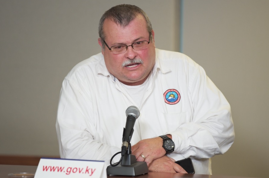
Appearing on Compass TV’s ‘Forefront’ show on 28 May, Hazard Management Cayman Islands Director Dani Coleman discussed preparedness, vulnerable populations and lessons learned from the Hurricane Melissa experience last year in Jamaica. She stressed the importance of continuous improvement, “Let’s not talk about resiliency as a stagnant tool, because resiliency is about getting better and moving forward.”.
Hurricane preparedness
As forecasters look toward an Atlantic hurricanes season expected to be heavily influenced by a strong El Niño, attention is often focused on the number of storms expected to form. Yet history repeatedly demonstrates that it takes only one hurricane, one major flood or one damaging earthquake to test a country’s preparedness.
But resilience is built incrementally, not in a single budget cycle, a single hurricane season or a single government administration.
The responsibility for resilience does not rest solely with government agencies and emergency managers; every hurricane season provides a reminder that preparedness begins at home.
Families need plans. Emergency supplies need to be checked. Important documents need to be protected. Vulnerable relatives and neighbours need to be identified long before a storm appears on the horizon.
Reliable information remains one of the most powerful preparedness tools available. Official updates can be found through gov.ky, the Cayman Islands National Weather Service at weather.gov.ky and Cayman Prepared, and disseminated through media outlets like Radio Cayman and Compass Media.
Clarke urged residents to the follow the information from Hazard Management Cayman Islands about how to prepare, “Ensure you have your plan in place. If you have never experienced a storm before, then talk to someone who has. Check the official websites and get as much information as you can and make sure you are prepared.”
Related Videos


