
For the latest information on storm activity in the Cayman Islands, as well as information on how to prepare for hurricane season, visit Storm Centre.
Repairs and debris removal continued Sunday, after Tropical Storm Eta caused significant flooding, downed power lines and uprooted trees across Grand Cayman and led to flooding and power outages in the Sister Islands.
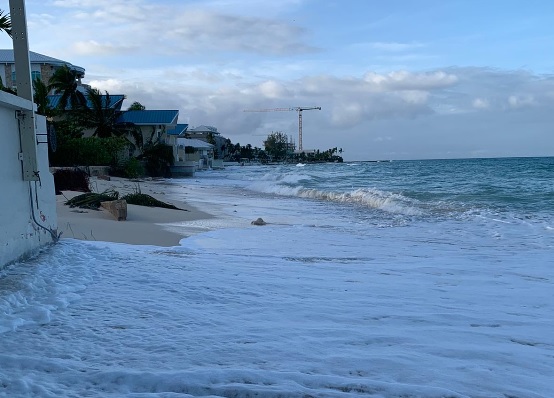
Strong waves and the high tides generated by Eta passing on the western side of Grand Cayman eroded parts of Seven Mile Beach, especially near Royal Palms.
Cayman’s National Weather Service, in its afternoon bulletin on Sunday, said Cayman can expect to experience isolated showers, along with moderate winds and seas of 2 to 4 feet, over the next 24 hours.
The regiment also evacuated several returning travellers who were in residential isolation. The regiment team wore full protective clothing to take the travellers to a government isolation facility, Commanding Officer Simon Watson said.
The regiment also dispersed emergency equipment packs across the island and checked on the well-being of residents.
Watson said there were a number of people who were concerned about relatives or people they knew, “So we dispatched teams to check on them to make sure that vulnerable people were safe.”
On Sunday morning, the regiment continued to return residents from emergency shelters or other accommodation back to their homes.
Premier Alden McLaughlin toured affected areas with the regiment on Saturday evening, after the all-clear was given.
He said, “It was very good to be able to see how well the regiment has performed as we add them to our list of first responders and help build Cayman’s resilience to deal with these situations.
“So I’m very grateful to everybody who has worked so hard over the course of the last few days to keep us safe and limit the amount of damage that properties have suffered.”
On Saturday morning, the storm had left more than 20,000 households without power on Grand Cayman, after heavy winds brought down electricity poles at several locations.
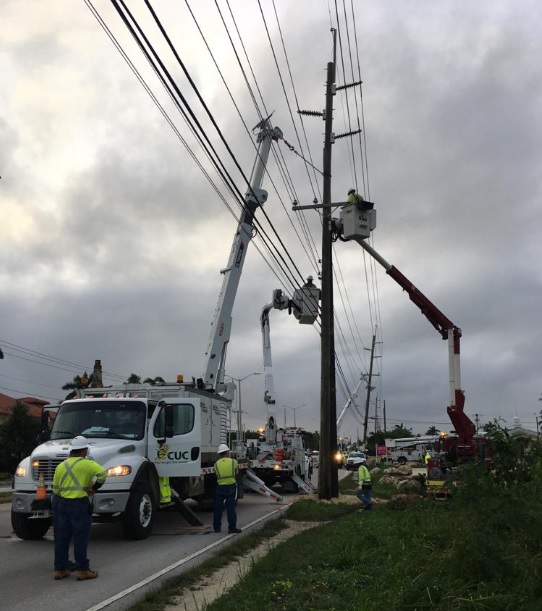
Caribbean Utilities Company crew had restored power across most of Grand Cayman by early Saturday afternoon. On Sunday morning, only 10 isolated outages affecting 37 households remained.
In a statement on Sunday, CUC said, “If you are still without power as a result of yesterday’s inclement weather, please call our outage hotline at 9451282 to report the outage. We thank all of you for your patience and understanding as our crews continue restore the island to full power.”
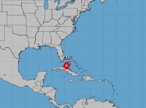
At 10am Sunday, the storm was located over northern Cuba, with heavy rains affecting Cuba and northern Bahamas. Tropical storm warnings are in effect in southern Florida, as at the storm moves in a northwesterly direction.
The US National Hurricane Center expects Eta to develop into a hurricane that could, by Monday morning, affect portions of the Florida keys, where authorities issued a hurricane warning.
Storm and flood warnings were lifted on Grand Cayman and the Sister Islands Saturday. However, a marine warning was still in place Sunday, as rough sea conditions were expected to continue, with large swells likely along the west coast of Grand Cayman.
While power outages also affected the Sister Islands, no structural damage was reported and all power has been restored. The all-clear was announced in the Sister Islands at 7pm Saturday.
Authorities in the Sister Islands are advising residents to remain off the roads if possible, facilitate the work of damage assessment and debris removal.
Two new systems form
The National Hurricane Center is monitoring two new weather systems which have formed in the Atlantic.
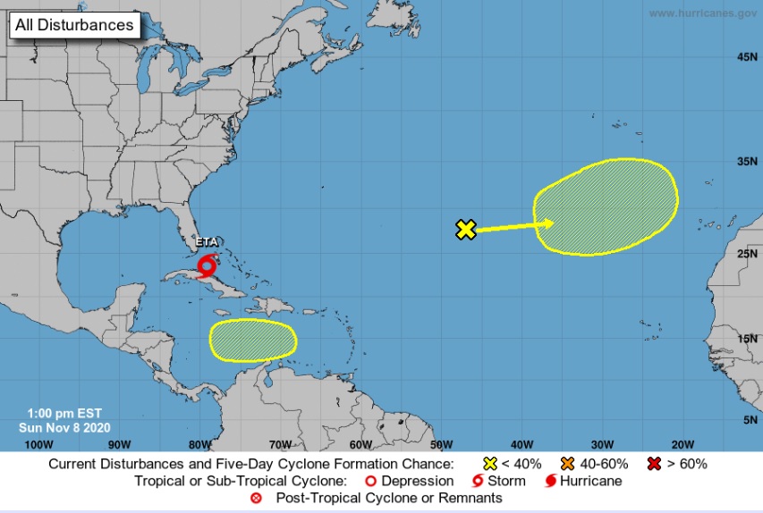
The first disturbance is a low pressure system that has developed several hundred miles southwest of the Azores. Shower and thunderstorm activity associated with this system is
currently disorganized, the NHC said, but it could slowly develop tropical or subtropical characteristics during the next several days while it moves eastward or east-northeastward over the northeastern Atlantic Ocean.
The second system, a tropical wave, is forecast to move over the central Caribbean Sea,
where an area of low pressure could form in a few days, the NHC said. Environmental conditions may be conducive for at least gradual development while the system moves slowly westward through the end of the week.
Related Videos


