
In a continuing Cayman Compass Issues series examining the use of technology in the Cayman Islands, this week we look at smart-tech as it relates to environmental and conservation matters.
Drones are being used by several government departments, organisations and companies in the Cayman Islands for a variety of purposes, from law enforcement to monitoring the health of Cayman’s reefs to keeping an eye on baby booby birds.
While drones – or ‘unmanned aerial vehicles’ – are not exactly new technology, as they become more sophisticated, reliable and popular, their uses are expanding exponentially.
DoE monitoring birds, turtles, beach erosion
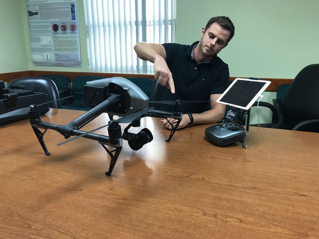
The Cayman Islands Department of Environment, for example, has a team of four licensed drone operators, who use the equipment in a wide range of its work.
Nathan Dack, a sustainable development officer at the DoE, and one of the drone operators, walked the Compass through some of the uses his department has for the drones.
He explained that the drones enable the DoE to quickly capture images of a certain site or landscape. Then, by comparing those images to Lands and Survey Department aerial photographs which are taken every four to five years and which include a back catalogue dating back to the 1950s, the DoE can assess alterations that have been done in the intervening time.
These are often used when the DoE is compiling a submission in response to a planning application, and enables it to ascertain historical and potential impacts of development in an area.
Dack said the last mapping was done by Lands and Survey in 2018, which forms a baseline for many of the projects the DoE looks at.
The drones are also used to confirm reports of silt caused by construction, and whether developments have erected silt screens.
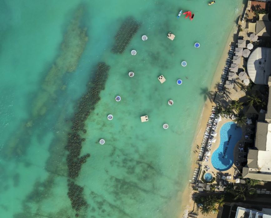
The DoE also deploys the drones to assess beach erosion, and the technology has been used recently to gauge the level of erosion along the southern end of Seven Mile Beach.
It has also been used in recent months to get a close-up look at plant regrowth at a wide swath of the Ironwood Forest in George Town that was burned in a major fire in April.
“We’re able to map the regrowth and see if any invasive species [of plants or trees] are appearing,” Dack said.
The drones have also been used to determine the impact of other disasters, such as when the 328-foot cargo ship Saga ran into a reef off Eden Rock in 2016. In that case, the DoE used drones to map from above the exact areas that were damaged.
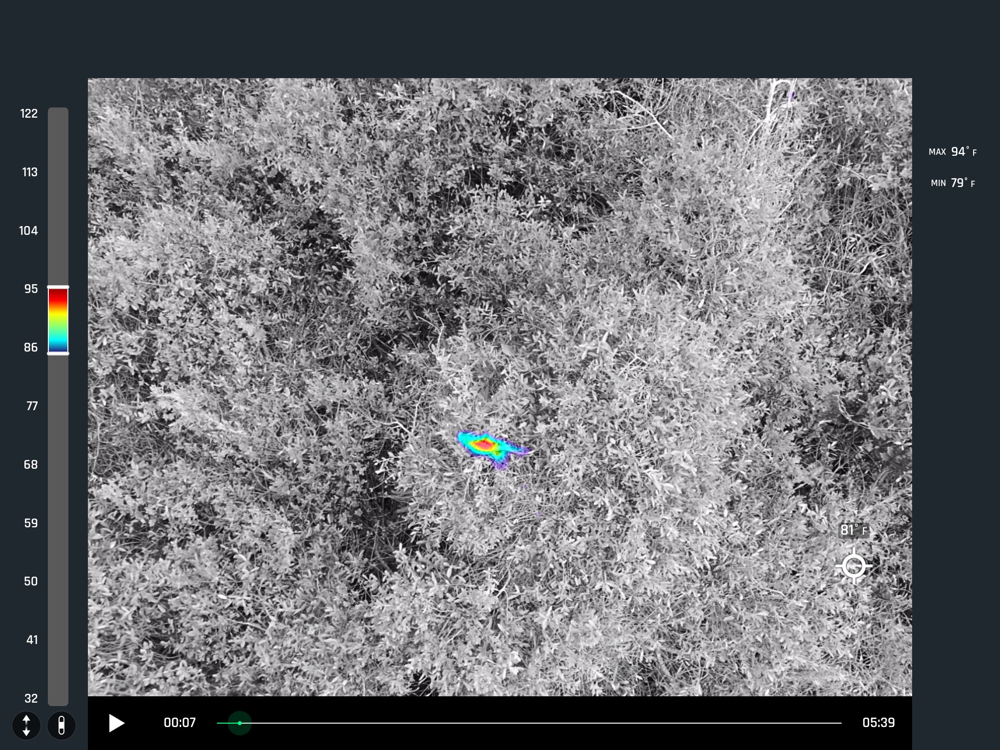
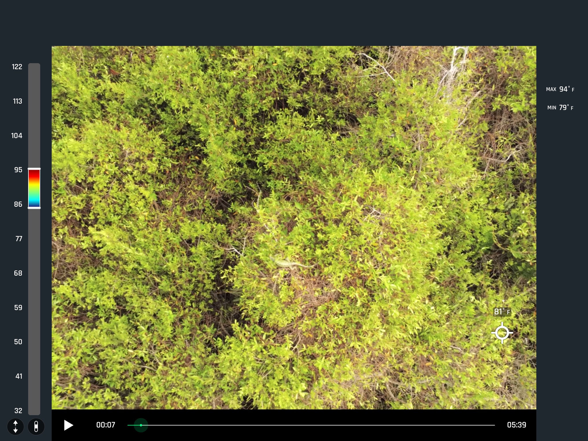
Pilot projects involving the drones have included monitoring of turtles and their nests, as well as finding invasive green iguanas on Cayman Brac.
Dack said the green iguana programme, carried out by a group of scientists from the University of Harrisburg in the US, used thermal imaging which enabled them to see the outline of the iguanas in trees.
The drones are also being used to track seabird density and nesting on the Sister Islands.
“We fly along the Bluff on the Brac, and at the mangroves at the Booby Pond on Little Cayman [to monitor booby birds],” Dack said.
While the nests themselves may be difficult to spot, the white-feathered baby boobies stand out in stark contrast against the background of the nests, he explained.
The small aerial vehicles are also used to monitor influxes of sargassum along the local coastlines, along with the subsequent impact and die-off of sea grass. Dack said the drone cameras captured images along South Sound, Frank Sound, Bodden Town and East End in recent years and have been able to make year-on-year comparisons.
Underwater tech
It’s not just in the sky where unmanned vehicles are being used.
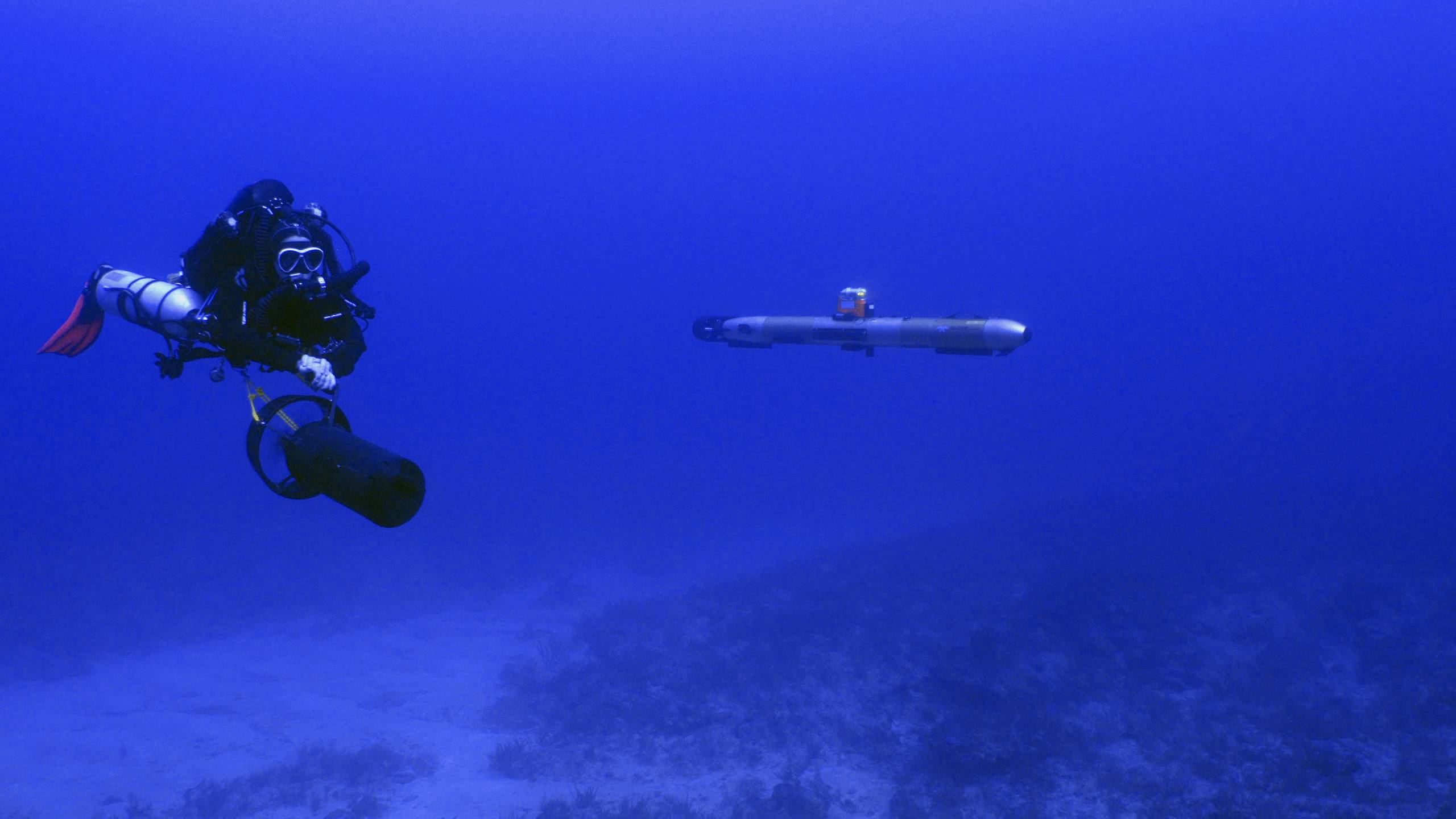
The Central Caribbean Marine Institute, based in Little Cayman, is hoping to use robots, or ‘autonomous underwater vehicles’, in its work, according to CCMI’s director of research, Gretchen Goodbody-Gringley.
“Working in collaboration with Dr. Arthur Trembanis from the University of Delaware, I have previously conducted mapping and habitat characterisation studies using an AUV in combination with technical diving [in Bermuda],” she said.
This vehicle, called the Gavia, can map the topography of the ocean floor, she said in an email to the Compass.
She added that CCMI “hopes to incorporate this technology into future [studies] in Cayman to map the local coral reefs and explore offshore seamounts”.
Other technology CCMI is considering introducing to monitor the health of coral reefs in Cayman is closed system chambers that can assess how corals tolerate various temperatures and a Diving-Fluorescence Induction and Relaxation (FIRe) fluorometer which measures photosynthesis of corals across various depths.
CCMI also uses hi-tech gadgets, including aerial drones, to share the work it does via education and outreach programmes. Its ‘Reefs Go Live’ programme uses sophisticated video and audio techniques to stream live seminars and research footage, in real time, from underwater to students and citizen scientists all over the world.
Policing from the air
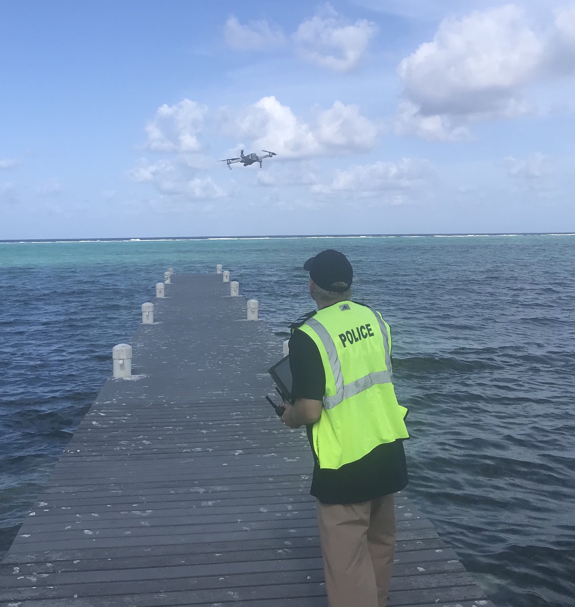
The Royal Cayman Islands Police Service helicopters are familiar sights in the local skies, but the RCIPS has also been using drones for more than three years, mostly in the line of public safety. These drones are considered a “deployable resource”, alongside the police helicopters, which are operated by the RCIPS Air Operations Unit. This unit is one of the few licensed drone operators permitted to fly at night and beyond line of sight.
Use of drones rather than helicopters by law enforcement agencies means helicopters do not always have to be deployed, meaning less noise pollution and less use of fuel. For example, a police drone was used at the 2019 KAABOO music festival to help with event management and crowd monitoring.
“Other features allow UAVs to launch within a minute, which provides the police with immediacy and flexibility. Other typical usage is the recording of crime scenes and serious motor vehicle accidents, and enabling accurate 3D reconstructions in HD quality after the event, a police spokesperson said.
Steve Fitzgerald, head of the RCIPS Air Operations Unit, said, “Having access to both manned and unmanned assets within the same unit ensures a combined and effective use of police resources”.
Related Videos


