
Forecasters say a passing tropical wave is expected to drench Cayman in approximately half-an-inch of rain, accompanied by the occasional rumble of thunder.
“We were expecting to get some more showers, but it seems that most of the rain occurred over the sea, just south of us,” Cayman Islands National Weather Service forecaster Kerrie Forbes told the Compass. “We do have to keep an eye on it though, as the models which only go as far as next week Monday, show that system travelling north of Cuba.”
Forbes added, “The satellite images show the majority of the tropical wave is further out to sea.”
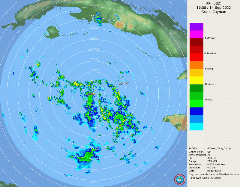
The midday showers were felt all across Grand Cayman, and much of the sister islands, and were captured on the national weather services’ Keanery Gomez Doppler Radar, which was recently brought back online following a series of repairs.
“We expect it to clear up by tonight, as it moves further west and out of our area by this evening,” she said. “And, come tomorrow we anticipate the usual partly cloudy skies, with afternoon showers.”
Another storm brews in the Atlantic
Further east, another tropical disturbance which is expected to develop into a tropical storm has caught the eye of local and regional forecasters.
However, Forbes said, the storm “does not pose any immediate threat to the Cayman Islands”.
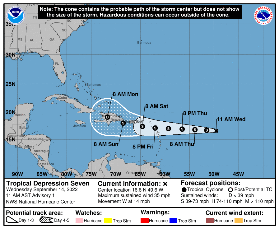
According to the National Hurricane Center in Miami, Florida, the tropical disturbance is expected to strengthen into a tropical storm by 8am on Thursday, 15 Sept.
The system is expected to move through the Leeward Islands sometime on Friday, bringing heavy rainfall and possible wind impacts,” warned the NHC. “The system could move near or over portions of the [US and British] Virgin Islands, Puerto Rico, and Hispaniola this weekend and early next week…”.
If the system does strengthen it would become Tropical Storm Fiona, the sixth named storm of what has been the slowest hurricane season in 30 years.
Related Videos


