
For the latest information on storm activity in the Cayman Islands, as well as information on how to prepare for hurricane season, visit Storm Centre.
Forecasters say Cayman will continue to see isolated showers for the next 24 hours due to a fleeting pressure gradient that continues to tighten across all three islands, as Tropical Storm Harold continues to move further inland in Texas.
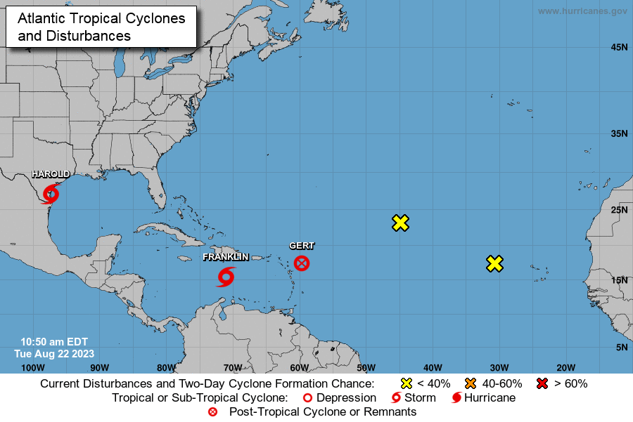
Though the weather forecast for Cayman calls for cloudy and rainy conditions, these are not related to the three named storms and two tropical waves that are currently in the Atlantic hurricane basin.
According to images supplied by forecasters at the US-based National Hurricane Center, Tropical Strom Harold is the closest storm to the Cayman Islands, but poses no immediate or expected threat.
“Heavy rainfall is expected across south Texas early Wednesday, and may produce areas of flash and urban flooding,” warned the NHC, which added that those conditions are expected to last for several hours.
The strongest system that is currently brewing is Tropical Storm Franklin which, as of midday Tuesday, 22 Aug., was approaching the southern coast of Hispaniola.
The NHC warned that Franklin is expected to travel directly over Hispaniola, with the brunt of the storm travelling across the Dominican Republic.
“Franklin is expected to bring tropical storm conditions to portions of the Dominican Republic and Haiti, where Tropical Storm Warnings are in effect, beginning later today and continuing through Wednesday,” the NHC said.
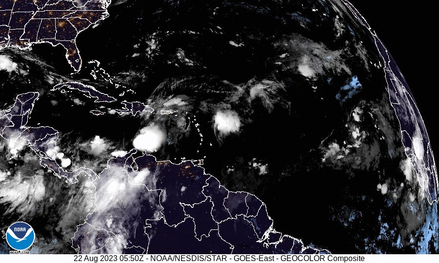
Further east, on the Atlantic coasts of the Lesser Antilles, Tropical Depression Gert, which was downgraded from a tropical storm, continues to deteriorate. The NHC is no longer providing any updates on this system.
The remaining two areas are tropical waves located in the tropical Atlantic Ocean, the first off the coast of the Cape Verde Islands, and the second in the central Atlantic.
Both systems have a low, 10%, chance of further development within the next two days.
Related Videos


