
Forecasters are keeping watch over a new system developing east-southeast of the Windward Islands.
The system, which at this time has a low percentage of formation in five days, is said to be a well-defined tropical wave.
Located about 750 miles east-southeast of the Windward Islands, it is producing disorganised showers and a few thunderstorms, the National Hurricane Center in Miami said in its Monday advisory.
“Although shower activity has diminished some this afternoon, recent satellite-derived surface wind data indicate that the wave has become better defined since yesterday,” the NHC said.
The system is expected to move westward to west-northwestward at around 15 miles per hour to 20mph.
At this time, the NHC has given the system a 30% chance of formation over the next 48 hours and, similarly, a 30% chance of formation through five days.
“Some additional development of this disturbance will be possible during the next couple of days before upper-level winds become less conducive for further organization by Thursday,” the NHC said.
The NHC said scattered showers were noted along the northern portion of the wave affecting Hispaniola and adjacent waters.
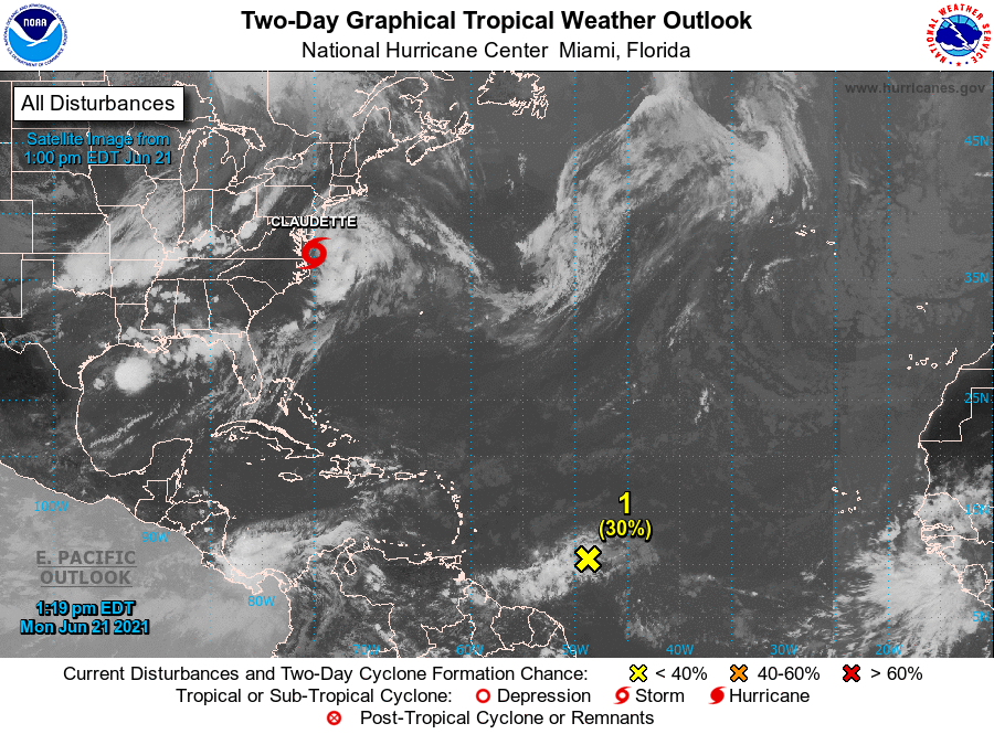
Meanwhile, Tropical Storm Claudette, the NHC said, is moving toward the east-northeast near 28 mph.
“An east-northeastward to northeastward motion with some increase in forward speed is expected over the next day or so. On the forecast track, the system will cross into the western Atlantic Ocean Monday, and pass just south of Nova Scotia on Tuesday,” it said in its advisory.
Maximum sustained winds are near 40 mph with higher gusts which are occurring mostly over water, southeast of Claudette’s centre, the NHC said.
“Some additional slight strengthening is possible over the western Atlantic Ocean today. Claudette is forecast to become a post-tropical cyclone Tuesday afternoon and dissipate late Tuesday night,” the NHC said.
Related Videos


