
For the latest information on storm activity in the Cayman Islands, as well as information on how to prepare for hurricane season, visit Storm Centre.
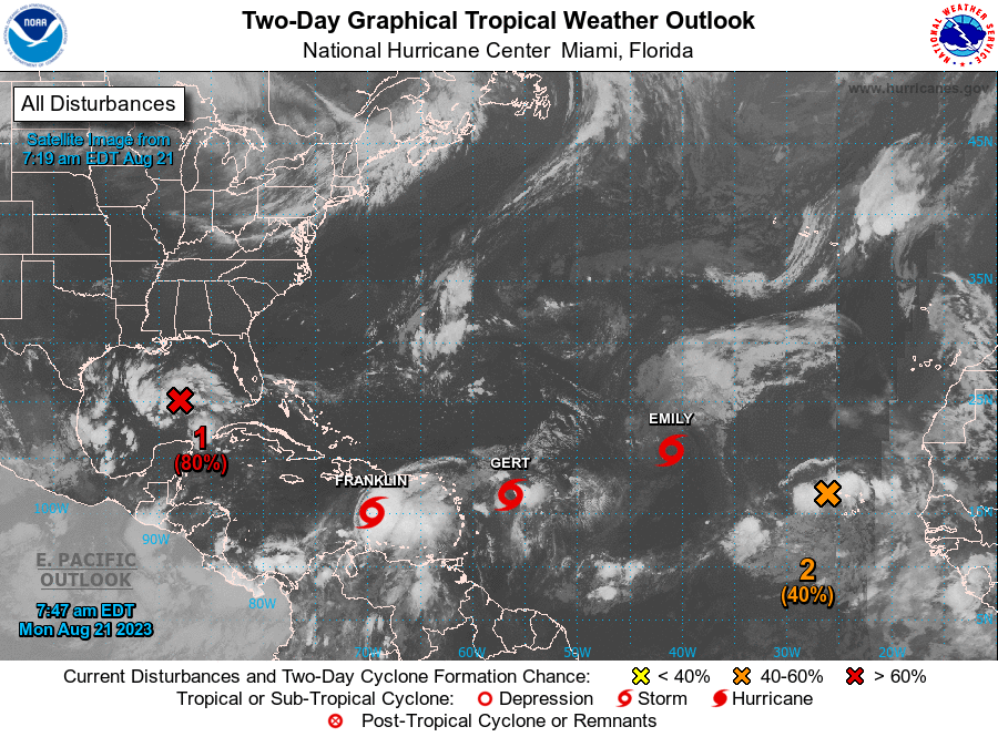
Regional forecasters are monitoring Tropical Storms: Emily, Gert and Franklin which developed over the weekend; in addition to two other potential weather systems.
None of the storms pose any immediate threat to the Cayman Islands.
Of the three named storms, Tropical Storm Franklin is the strongest and closest to the Cayman Islands.
As of Monday 21 Aug., Franklin was located in the eastern Caribbean, south of Hispaniola.
According to forecasters, at the US-based National Hurricane Center, Tropical Storm Franklin is likely to veer north and travel directly over Hispaniola, then grazing the southern Bahamas Islands before heading back out to the Atlantic Ocean where it is expected to become a Category 1 hurricane on Saturday 26 August.
“Heavy rainfall from Franklin is expected across portions of Puerto Rico and Hispaniola through the middle of the week,” warned NHC forecasters in their 5am weather bulletin.
NHC forecasters added, “The heavy rainfall may produce areas of flash and urban flooding as well as river rises and mudslides.”
Unnamed system drenched Cayman Sunday night
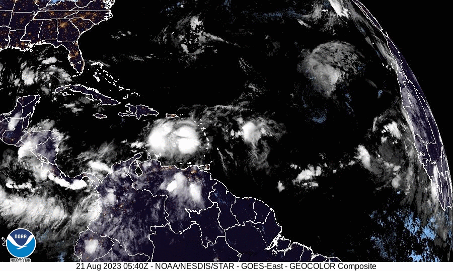
Several hundred miles north-north-west of the Cayman Islands is an unnamed system which drenched Cayman in several inches of rainfall Sunday night as it passed through the region.
“Isolated showers with moderate winds and seas are expected for the next 24 hours over the Cayman Islands in association with lingering moisture over the Northwest Caribbean from a tropical wave currently moving west over the Yucatan Peninsula,” advised the Cayman Islands National Weather Service.
The CINWS added, “Radar images show isolated showers in and around the Cayman area moving towards the west.”
According to the NHC the tropical wave has an 80 percent chance of developing into a tropical depression or storm within the next two days.
“Environmental conditions appear conducive for development of this system, and a tropical depression or tropical storm is likely to form before it reaches the western gulf of Mexico coastline on Tuesday,” warned the NHC.
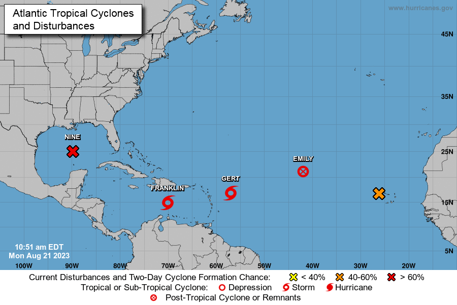
Tropical Storms Emily and Gert to continue weakening
In the Western tropical Atlantic “short-lived” Tropical Storms Emily and Gert continue to unravel as they encounter unfavorable conditions.
According to the NHC Emily is travelling in a west-northwesterly direction at 12 miles per hour, with maximum sustained winds of 40mph.
Tropical Storm Emily poses no threat to any land mass and as such the NHC has stopped issuing updates on this system.
Although Tropical Strom Gert is slightly stronger than Emily, and is currently producing rough seas, occasional gusts and showers across parts of the eastern Lesser Antilles, forecasters say this system will also dissipate in the coming days.
“The tropical storm is highly sheared with the deep convection located over the eastern quadrant,” advised the NHC, adding that Gert will weaken to a remnant this afternoon and dissipate by Tuesday evening.
Tropical wave moves off coast of Africa
The final area that is currently being monitored is a tropical wave over the Cape Verde Islands off the West African coast.
Forecasters say the system has a 40 percent chance of developing into a tropical depression within the next two days, at which time it is expected to drift further into the Atlantic Ocean.
“Environmental conditions appear generally conducive for gradual development of this system, and a tropical depression is likely to form later this week while it moves west-northward across the eastern tropical Atlantic,” advised the NHC.
Related Videos


