
Forecasters are currently monitoring three tropical systems across the Atlantic hurricane basin.
None pose any immediate threat to the Cayman Islands.
The strongest of the three systems is a tropical wave that, as of 8am Monday was 900 miles east-southeast of the Southern Windward Islands. According to the National Hurricane Centre in Miami, Florida, the tropical wave has a 70% chance of strengthening within the next 48 hours.
“Environmental conditions appear conducive for further development, and a tropical depression is likely to form during the next couple days before the system reaches the Windwards Islands Tuesday night or possibly while moving westward across the southern Caribbean Sea Wednesday through Friday,” the NHC bulletin stated.
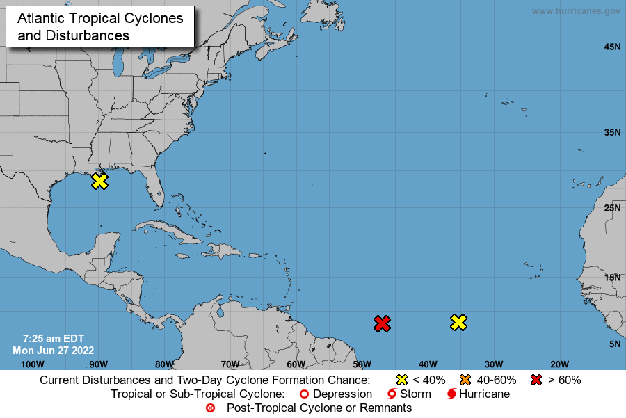
Further east, another disturbance has been spotted in the middle of the southern Atlantic Ocean.
The system is moving at 15mph in a west-northwesterly direction and is currently producing thundershowers.
The third system the NHC is monitoring is a disturbance along the coast of Louisiana.
“Disorganized showers and thundershowers over the north-central Gulf of Mexico are associated with a trough of low pressure,” states the NHC weather bulletin. “Development of this system is expected to be slow to occur while it moves west-southwestward at about 10mph.”
Related Videos


