
Sea-water laps at the southern shore of West Bay island.
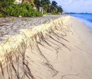
Waves wash over the sunken remnants of Seven Mile Beach.
To the east, a vast wetland stretches from Savannah to Gun Bay. The isolated Colliers Isle sits at the centre of a brackish lagoon.
It is high-tide 2050 and Grand Cayman has splintered into a chain of multiple tiny islands, separated by shallow waterways carved by surging seas.
The visualisation is based on mapping data from US-based Climate Central – a group of scientists and journalists set up to communicate climate-change science, effects and solutions to the public and to decision-makers.
The validity of such maps is often disputed and the ability to visualise the complex impacts of rising seas on a built environment in two dimensions is fraught with complexity and contains significant margin for error.
We have reproduced the map here largely as a thought experiment and a conversation-starter that we hope fuels further discussion about some of the worst-case scenarios facing Cayman as the global climate changes.
It also serves as a partial guide to the areas of greatest risk – perhaps not from being submerged, but at the very least from being exposed to storm surge, flooding, erosion and other climate impacts.
The data
Climate Central’s global coastal impact mapping tool compares projected sea levels against existing elevation and shows which areas would be below the tide line in various scenarios.
The map shown on this page uses the leading consensus projections from the United Nations Intergovernmental Panel on Climate Change for 2050. It is a relatively crude tool and local experts caution that far more precise data is needed as the basis for planning and development decisions.
Peter Girard, of Climate Central, said the map tool used coastal digital elevation models to provide the baseline data and compared them against projections from widely accepted scientific sources, like the IPCC report.
The base data from the elevation models is accurate to within 3 centimetres globally, according to a peer-reviewed paper published last year.
There are points on the Cayman maps, however, that don’t appear to factor in areas that have been filled to a higher level and in some cases show sea-level impacting cliff shoreline. These anomalies are likely due to the scale of the mapping data available to the model.
You can use the map tool to examine different data projections and time lines here.
More precise projections in progress
The Cayman Islands Department of Environment argues that such maps are useful on a broad scale to identify at-risk areas but are not sufficently precise to be a decision-making tool at ground level.
“These internationally sourced projections are able to show the general areas where we can expect to see significant impact from sea level rise. Since these types of models usually rely on global digital elevation data, it is important to remember that the resolution of these models will be much coarser than the resolution required to show which specific properties on the island will be impacted by climate-change induced sea level rise,” the department said in a statement.
“Overall, they offer a macro reference for use in future planning for infrastructure risks, for example, and are a good indication of those areas that will be at greater risk than others.”

The DoE is working with consultants and other government departments on more precise mapping work as part of an ongoing climate risk analysis for the island.
Fighting the tide
LIDAR data – using airplane mounted lasers – has been used to measure the topography around Cayman and overseas experts are assisting with storm surge and inland flood modelling.
“On the scale of the Cayman Islands, this finer scale modelling will be more useful for future planning,” the DoE said.
Until that data is available, less accurate global mapping provides a broader, layman’s view of possible impacts.
Girard said Climate Central’s projections are considered extremely reliable in general, but the mapping tool covers the entire globe and he acknowleged local measurements would be required to verify the work and support any responsive action.
Rising risks
The map’s projections don’t necessarily mean that the areas, colored red on the Climate Central maps, would be permanently under water, but without modifications they would face incursions from the ocean at high tide.
“The areas shown as at-risk are projected to see more severe and more frequent coastal flooding as sea level rise accelerates,” Girard added.
Daniel Gilford, a climate scientist on Climate Central’s sea-level rise team, said beach erosion, extreme king tides and greater-than-usual flooding following storms – all observed in recent years in Cayman – were expected impacts of sea-level rise.
As well as painting an alarming picture of a possible future, the maps serve as a guide to which areas are at the greatest risk now.
“As sea levels rise, coastal floods become more frequent and more severe, including tidal floods or ‘sunny day’ floods that aren’t influenced by weather systems. They all increase erosion and damage to exposed buildings and infrastructure and, without protection, the risks will only increase as sea levels rise over the next 30 years,” he said.
“Some impacts will be unavoidable; as our maps show, much of the sea level changes through 2050 are ‘locked in’ regardless of human emissions.”
The aim is not to frighten people with doomsday scenarios. He said properly understanding the possible impact of scientific projections in a practical way would allow communities to adapt and protect lives, property, history and culture for future generations.
“This can also ensure that future developments occur in places and ways that anticipate worse flooding in the years to come,” he added.
Related Videos


So if you believe some of this is true, or could be true (and we all should) to one degree or another, then all of us should be able to see why development is so important to this Country. If we encourage people to come and build here and immigrate and develop, the Country gets a bunch of new stakeholders invested in protecting our shores against the rising tide of inevitable. If we shoo people away and ward-off development, this Country will shrink. The economy here will begin to devolve and there will be nobody here to stand with us and stare at the sunken mangroves. This same problem will play out around the World and those Countries smart enough to recognize the problem early and welcome inward investment creating inertia will be the winners. There will be a lot of losers too. Let’s not let Cayman be one of them.
Frank,
This strategy is akin to saving yourself from drowning by pushing your children’s heads underwater. We are all in this together. We, as one world, are facing an existential threat. The only way to overcome this existential threat is by working together. Not pretending that our country is in some cosmic economic competition. There can only be losers when playing this game.
For this type of thinking is the very source of this problem. No amount of money, technology, or development will solve this problem, they will only make it worse. The more concrete we pour on to our beloved isles, the faster our paradise will sink into the sea.
Once upon a time our people respected the land and respected the sea. We built where it was sensible. Life was slower, less material, more fulfilling. The answer to our problems is not to double down, throw more money at it, and continue thoughtlessly accelerating with more development. The answer is to slow down and be mindful of our every action. To ask the simple questions: What do we want our country (and Earth) to look like? What are we working towards?
Our Earth is being burned alive with the desire for more more more. Feeding this desire will never be the answer. The answer lies in us all collectively slowing down, being thankful for what we have, and working together towards a better world.
Welcoming development investment does not seem to be the problem. Directing it to ‘good’ (socially & climatically beneficial) development does.
Mixed-use development (by area – a CI Planning issue) that are integrated socially/economically (again, needs local policy to guide what that looks like to the Cayman Islands) and that don’t make the future flooding issues worse (area flood plans which may include recognising/compensating some properties as ‘unsuitable for development’ or ‘reserved for national/district/area flood control’, think parks with ponds perhaps). None of this is an ‘investment’ problem. Nor is ‘unrestricted development’ driving social growth the solution.
What happened to the government’s 21M plan to fix SMB. Every day they wait it only gets worse